Here's something you might be interested in.
Lost roads of San Diego
Whatever happened to Allen's Dairy Road, Harasthy Street, Liberator Street?

Camino del Rio South. In July, 1982 city councilwoman Susan Golding and Pete Wilson aide George Gorton were robbed at gunpoint in the Lehr’s parking lot.
Author Margot Sheehan wrote for the Reader 1991-1993. She edited a satire page in 1991 called "San Diego Confidential." After she was let go from the Reader in 1993, Sheehan threatened litigation based on what she said was discrimination. In 2020, a writer using the name M.E. Burns wrote a eulogy for George Mitrovich, San Diego’s infamous political gadfly, and in 2023 under the name Meg Burns, appeared an obituary for Colin Flaherty, a former writer for the Reader and son-in-law of Congressman Lionel Van Deerlin. Both stories had earmarks of Margot Sheehan's writing.
Allen's Dairy Road
Mission Hills is a real enclave, accessible from downtown or Mission Valley only by roundabout routes. Seventy years ago, developers didn’t want any trunk roads through this new, genteel neighborhood; near its western perimeter lay tawdry commercial strips and the muddy Mexican slum of Old Town.
Allen's Dairy Road. The Allen kids buried the body of a Model T somewhere along the road in the 1930s.
Residents have maintained this insularity ever since. For example, in the early 1940s, the city wanted to build a Washington Street extension through Mission Hills to the Pacific Highway. The locals balked at the notion or a new highway cutting the neighborhood in two. So the proposed route ended up bypassing Mission Hills entirely. It veered sharply to the southwest from Washington and Hawk streets, eventually meeting Pacific Highway at the bottom of a canyon. That’s how we got the steep Washington Street extension that runs past Gelato Vero Cafe.
And then there’s the matter of Allen’s Dairy Road, or Allen Road, as it’s called nowadays. It runs from Fort Stockton Avenue (next to Ron Kiefer’s Gourmet Deli)> all the way down to Mission Valley, a quarter mile east of the Presidio.
Leave your car and bike behind when you visit Allen Road. It’s a bonafide city street, but only the first hundred yards are paved. Therein lies our story:
In 1885 Mr. and Mrs. Sereno Allen arrived here from Kansas, went into the milk business, and raised 13 children. Their dairy prospered under sons Fred and Harvey, who owned two ranches in the valley, pioneered door-to-door delivery, and kept a retail shop in Hillcrest. It wasn’t till 1957 that Sereno’s grandson John Allen finally sold the Mission Valley spread and moved his cows to El Cajon.
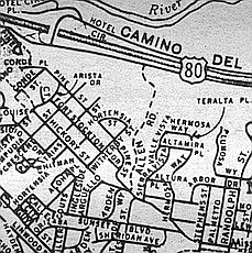
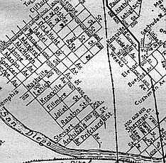
Allen Dairy Road on a 1963 map
During the 1920s and ’30s, the Allens used to send their milk trucks up to Mission Hills and Hillcrest via the steep-canyon path near the dairy. “It was just a little dirt road that served the dairy, which was down on a two-lane dirt road down in Mission Valley,” recalls Chuck Barr, who grew up in Mission Hills during the ’20s and ’30s. “I knew some of the Allens; I remember Richard Allen — he was the smart one in the family, got out of the dairy business, went to Cal Tech. There’s a story that the Allen kids buried the body of a Model T somewhere along the road. In the early ’30s they had this Model T that they fixed up to aquaplane along Torrey Pines beach. Well, you know, the body got rusted. So what they did was get a new body and put it on the old engine. They left the rusted old body north end alongside the road down there, and I remember there was an awful stink about it, with neighbors complaining. They never moved it, so I guess it’s still there!”
In those days city maps called this milk-truck route Canyon Road (there was already an Allen Street, near Morena Boulevard). But Mission Hills residents always called the street Allen’s Dairy Road. When the other Allen Street was obliterated by floodway plans in the 1940s, the city officially designated the Mission Valley truck-path as Allen Road and made plans to grade and pave it.
Mission Hills residents blocked the proposed improvement on Allen Dairy Road for 20 years.
Mission Hills residents blocked the proposed improvement for 20 years. In the 1960s the city finally gave up and posted a sign at the Mission Valley end: Road Closed, per city vehicle code.
This northern end of Allen Road is now in the back lot of the Ramada Inn on Hotel Circle. A few motels to the east, where the dairy buildings once stood, we now have the Mission Valley Inn.
Harsathy Street — Middletown
Surely you remember Colonel Agostin Haraszthy, the Hungarian-born city father who was our first sheriff in 1850 and built the first jail (his first prisoner, Roy Bean, is said to have escaped within an hour by digging his way out with a penknife). No? Come on, you must know Haraszthy, that blackguard who was later accused of embezzling at the San Francisco mint, helped start the California wine industry, and was finally eaten by alligators in Nicaragua!
Haraszthy! The man who founded Middletown and even had a street named after him!
Not too many people do remember the old adventurer, nor did they 40 years ago, when the city wiped Harasthy [sic] Street off the map.
Harasthy Street on 1925 map
The street itself is still there, it just goes by another name — Washington Street. Part of it stretches for two and a half blocks from Kettner to Pacific Highway; the remainder is used as a drive by the Convair plant at Lindbergh Field.
Haraszthy was our first sheriff in 1850 and built the first jail – his first prisoner, Roy Bean.
Harasthy Street was laid out and named in the mid-19th Century, one of many short streets that ran east-west in the vicinity. Its parallel neighbors are named for Colonel Haraszthy’s contemporaries — Bean, San Diego’s first mayor (and Judge Roy Bean’s brother); Sutherland, San Diego’s first lawyer; Clayton, the first county surveyor; Emory, hero of the battle of San Pasqual. Their stumpy little streets survive, but only just barely. Sutherland, two blocks north of the Mission Brewery, is no more than a parking lot, though it still gets a street sign. Clayton Street doesn’t even rate a sign.
The misspelling of Colonel Haraszthy’s name seems to be a mapmaker’s error. When county surveyor James Pascoe laid out the first authoritative map of San Diego in 1870, he spelled the street Harasthy; and Harasthy it remained.
Harasthy Street’s brightest hour came at the end of World War'll, when the city opened its new “Washington Freeway,” a short concrete highway built to provide quick access between the Pacific Highway and Route 80 (El Cajon Boulevard). After nearly a century of being a forgotten side street, little Harasthy was now one of the main drags in town.
But motorists found it all too confusing. They’d drive straight down Washington, pass the Mission Brewery building, and then suddenly discover they were on this other street with an unpronounceable name. In 1952, Harasthy was redesignated West Washington Street.
At the corner of California Street and old Harasthy, the San Diego Trolley people plan to open a station in 1995. Its name: Washington Station. Surely poor Colonel Haraszthy deserves better.
Buchanan Avenue — University Heights/Mission Cliffs
Named after the saddest of Democrats, it’s one of the saddest streets in town.
You need a good grounding in 19th century American history to explain the street names that occur on the southwest fringes of University Heights, where that turn-of-the Century subdivision meets Hillcrest. Some are easy enough: Johnson Street, Hayes Street, Cleveland Street, Tyler, Polk, Van Buren, and Garfield streets — presidents all. But whatever were they thinking of when they came up with Blaine Street, named for the GOP nominee who lost the presidency to Grover Cleveland in 1884? The street namers must have been Republicans.
And then there’s Buchanan Avenue. Named after the saddest of Democrats, it’s one of the saddest streets in town.
Buchanan on 1925 map
How sad? It’s a canyon path covered with weeds. No one is ever recorded to have built so much as an outhouse there. But Buchanan Avenue still appears on the Thomas Bros, maps of San Diego.
Buchanan Avenue was laid out as University Heights’s only direct approach to Mission Valley. When contractors paved the local streets in the early 1920s, they left a 50-foot gap in the walk along Johnson Street. This is where Buchanan Avenue was supposed to fork off from Johnson. Seventy years later, the gap is still there. Beyond it lies the ridge of a canyon that meanders north and northwest to Mission Valley.
Mission Cliffs “It’s nice and quiet up here."
You can see a bit more evidence of a road at Buchanan’s northern end. Go down into Mission Valley and park in the lot of the Holiday Spa. At the southern end of the lot you’ll find a one-lane dirt-and-gravel path that leads you southeast for 200 yards, then forks into two dirt roads. On the left, leading north, you have the remnant of Massachusetts Avenue, a short, paved stump of which still thrives in Mission Cliffs. The right fork, leading southeast, is Buchanan Avenue, vanishing quickly into weeds and rubble.
Why weren’t these canyon roads ever finished? An old timer in Mission Cliffs says, “It’s nice and quiet up here. Don’t want strangers driving by all the time.”
Anna Avenue — Morena Area
In 1950 Santa Fe raised its trackbed, cutting Anna in two.
Anna Avenue nestles among thoroughfares named for 19th-century generals — Grant Street, Custer Street, Sherman Street —- so you might suppose that the street is a tribute to the mid-century Mexican dictator General Santa Anna. Actually, Anna is very much a girl, the sole survivor of a trio of sister streets laid out at the turn of the century near the southeast corner of Mission Bay. Isabel Street, to the northeast, and Margaret Street, to the southwest, were stillborn: planned but never developed or paved.
Anna on 1925 map
Little Anna thrived and grew, eventually crossing the Santa Fe railroad tracks and meeting up with Sherman Avenue. When the Pacific Highway opened in 1933, Anna was the access route between the businesses on the old Route 101 (Morena Avenue) and the new highway. Around the same time, an airfield called Peik Airport started up near Mission Bay, just north of the present-day Highway Patrol headquarters. And the main road to Peik Field — in fact, the only road — was Anna Avenue.
By the start of World War II, Anna was a wonder. You could walk its entire length in 15 minutes, yet go from a railroad freight yard to a major U.S. Highway to an airport. But Peik Field shut down during the war, and a few years later (1950) Santa Fe raised its trackbed, cutting Anna in two. The worst blows came in the ’50s and ’60s, when Mission Bay Park and Interstate 5 buried all of Anna west of Pacific Highway.
Two stumps of Anna remain today, bisected by the train tracks. The western one serves as a frontage road for businesses along Pacific Highway. The eastern stump, by the San Diego Humane Society, is not even marked by a street sign.
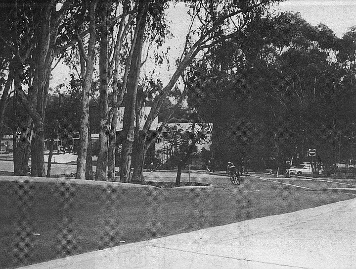
Route 101: “Suicide Alley” — Morena Area
Any local who had a driver’s license a generation ago can tell you about “Suicide Alley,” a stretch of the Pacific Highway just north of the Flood Control Channel. It was built in 1933, when the Morena Avenue route of U.S. 101 was being replaced by a new concrete highway to the west.
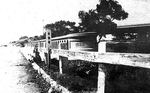
The bridge had been built to accommodate narrow-body flivvers of the early ’30s, and its four lanes were scarcely wider than a two-lane freeway of the 1950s.
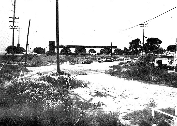
Thirty-odd years ago, this was the worst freeway bottleneck in the county. See the concrete bridge in the photo? The highway approached this structure in a shallow curve and then suddenly narrowed: the bridge had been built to accommodate narrow-body flivvers of the early ’30s, and its four lanes were scarcely wider than a two-lane freeway of the 1950s.
In the mid-’60s the state bypassed this bottleneck by building an overpass extension that curved to the northwest, re-connecting with Route 101 near Mission Bay, and finally terminating at Sea World Drive (then called South Mission Bay Drive or the Sunset Cliffs Boulevard extension). In 1969 the bridge was bypassed again by the newly opened Interstate 5.
Today this 300-yard section of highway and bridge is a frontage road for the Pacific Highway. It dead-ends suddenly at a storage warehouse.
Sharp-eyed 101-watchers will note that the bridge pictured has identical siblings elsewhere in town: on Mission Bay Drive in Pacific Beach and on North Torrey Pines Road, just south of Del Mar.
Convair Street, Vultee Street — Sports Arena Area
In 1944, the land between Midway Drive and Sports Arena Boulevard (then Frontier Street) became honey-combed with the short streets of a wartime housing project. After the war-workers went home, a motley collection of transients lived in the area. One was young Barbara Wood Graham, a fleet-following party girl who died in the electric chair in 1955 (Susan Hayward won an Oscar for playing her in I Want to Live!). Another was the brilliant German scientist Arthur Rudolph, whose Saturn rockets took us to the moon.
Looking south on Convair Street near its intersection with Liberator Street (now called East Street)
The Frontier housing project was closed in the early ’60s, and most of its streets obliterated. Liberator Street, named for the B-24 bomber, is now called East Street, a shopping-center route that runs by a Target outlet. Dartmouth Street is now a parking-lot drive in front of Home Depot; Convair Street, where they park the shopping carts for Ralphs supermarket.
Loma Portal, 1963
Vultee Street is today nothing more than parking spaces for one of those huge lots across from the Sports Arena. This photo is taken from the approximate spot of 3203 Vultee Street, where Dr. Rudolph lived with his family from 1946 to 1947.
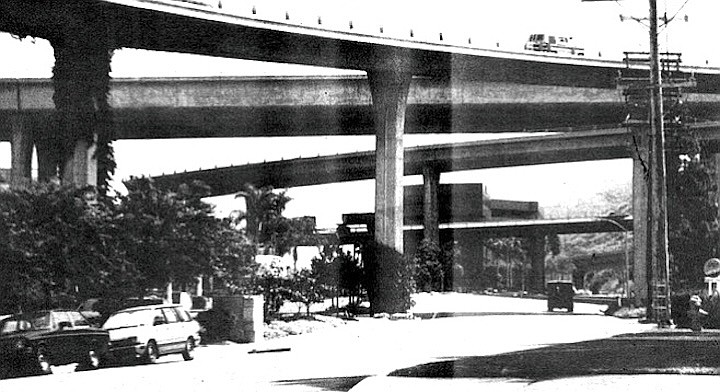
Homeland Place — Mission Valley
Savvy drivers in Mission Valley and Hillcrest know all about Bachman Road. It’s that semi-secret, semi-private canyon drive just west of the I-8-Route 163 interchange. Bachman connects Hotel Circle South with Bachman Place in Hillcrest and allows you to get from Mission Valley to Washington Street without getting on the freeway.
You’re not supposed to use Bachman Road unless you’re an employee of the UCSD Medical Center.
Trouble is, you’re not supposed to use Bachman Road unless you’re an employee of the UCSD Medical Center. UCSD took over this right-of-way in the mid-’80s in order to have an access road to their parking garage on Pill Hill.
Non-legit users of Bachman hardly ever get caught or fined. If security guards ask you for your ID, you can just say you’re lost, and they’ll happily show you the way out.
1957 map
If you’re in a belligerent mood, though, you may wish to insist that you have an easement to use the road. After all, the portion of Bachman in Mission Valley was for decades a city street called Homeland Place, a cul-de-sac that primarily served one of the local dairies. And at the Hillcrest end of the road is another city street, Bachman Place.
You might point out that you’ve been driving up this canyon every day for the last 50 years, and it’s not your fault if these Medical Center whippersnappers have gone and built themselves a parking garage near two of your favorite roads!
Maple Canyon Road — Bankers Hill/Hillcrest
In the days before I-5 tore the city core asunder with its S-curve, traffic along El Prado in Balboa Park was a problem. Motorists would commonly cut across Laurel Street and drive through Balboa Park to get to their destinations. In the late ’50s, the city proposed a “Laurel Street bypass” to end the east-west congestion.
The city found that it didn’t have the money to build tunnels under Quince or new bridges over the Cabrillo Freeway.
The traffic planners wanted a limited-access highway that wouldn’t disrupt existing streets. By happy circumstance, there was a deep canyon just north of Laurel Street, and it was here that they proposed to begin their new bypass.
Maple Canyon Road, as the project came to be called, was to run along the canyon floor from Laurel and Columbia and then emerge to join with Third Avenue near Redwood Street The bypass route would continue up Third, turn east on Upas, cut through the park, overpass the Cabrillo Freeway, and finally end at Robinson Street near Park Boulevard.
Preliminary survey and design work on the road began in 1960 and continued for several years. Hillcrest residents shot down the Upas Street route, so the city proposed an alternative: build a tunnel under Quince Street, from Third Avenue to the park.
The Maple Canyon Road idea finally died in 1963, when the city found that it didn’t have the money to build tunnels under Quince or new bridges over.Cabrillo Freeway. But city traffic was tapering off by then anyway; San Diego had gone into an economic tailspin and thousands of people were moving out of town.
By the time the city’s economy recovered in the late ’60s, new freeways and traffic patterns had mooted the question of a Laurel bypass.
In the end, the Maple Canyon Road project was a good thing for the Banker Hill area. It prevented development of the canyon area during the ’50s and ’60s, when cheap apartment buildings were springing up on nearby Reynard Way. Maple Canyon between Brant Street and Third Avenue remains one of the most secluded and bucolic spots in the city.
Camino del Rio South — Mission Valley, between Texas Street and Interstate 805
No other road in San Diego has seen as many name changes as the old Mission Valley Road. Seventy years ago the city decided to fancy up the two-lane dirt byway by renaming it “Camino del Rio.” The name never quite took; locals and newspaper stories alike persisted in calling it Mission Valley Road till the 1960s.
Camino del Rio South. The Caminos are the real thing — the same two-lane, winding Mission Valley Road that the farmers used 50 or 100 years ago.
In 1949 an extension was built east of Mission Gorge Road and titled the Alvarado Freeway. A couple of years later, the western half of Mission Valley Road was regraded and paved into a four-lane highway. In the late ’50s, Alvarado Freeway and Mission Valley Road/Camino del Rio were designated U.S. Highway 80. (Until then, U.S. 80 followed El Cajon Boulevard, Normal Street, and Washington Street as far as the 395 connector. Today these streets are an T8 business loop.)
Finally, in the 1960s, the road was renamed Interstate 8.
Today’s Camino del Rio South and Camino del Rio North are mostly frontage roads built from scratch in the early ’50s. Just east and west of Texas Street, however, the Caminos are the real thing — the same two-lane, winding Mission Valley Road that the farmers used 50 or 100 years ago.
The photograph shows a portion of the road near the 805 interchange. Hemmed in by a steep grade to the south and I-8 to the north, this portion of Camino del Rio South has never bustled with roadside businesses. In the 1970s, a restaurateur built a huge crystal-palace structure on the north side of the road. It soon went under, as did the three restaurants that followed. The last failure was Tijuana Tilly’s; the current occupant is something called Banx.
In 1982, the restaurant-of-the-moment was an upscale eatery called Lehr’s Greenhouse, and the parking lot was rumored to be a good place to score an ounce of cocaine. In short order, street crime arrived in this out-of-the-way pocket of Mission Valley. The most famous incident occurred in July of that year, when city councilwoman Susan Golding and her companion, Pete Wilson aide George Gorton, were robbed at gunpoint in the Lehr’s parking lot.
 It’s not the Santa Fe Railway that abolished California Street. The trolley folks at MTDB are the culprits.
California Street — Downtown
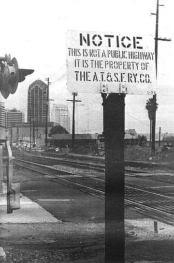
In case you didn’t notice, we lost a historic downtown street just recently. Toward the end of 1992, most of the street signs for California Street came down. We shall not see them again. California Street, that slummy 19th-century drive on the west side of the railroad tracks, is gone for good, and the only reminders left us are stenciled notices from the Santa Fe Railway:
NOTICE
THIS IS NOT A PUBLIC HIGHWAY
IT IS THE PROPERTY OF THE
A.T.&S.F. RY. CO.
Actually, it’s not the Santa Fe Railway that abolished California Street. The trolley folks at MTDB are the culprits. In the process of improving the track bed, they had to obliterate the one narrow access road to the tracks that form the route for the northbound Old Town branch of the trolley. That branch reached Harborview (Cedar Street) last year and is scheduled to arrive at Washington Street in 1995.

California Street on 1925 map
California Street became the street-beside-the-railroad-tracks around 1885, just before the first Santa Fe depot opened. In those days, California Street ran right alongside, or very close to, the harbor. Now it’s a bit more inland, thanks to a century of landfills that have made possible such wonders as Pacific Highway, Harbor Drive, and the County Administration Building.
Hemmed in by the railroad right of way, California Street never got very wide or stylish. By the turn of the century it had acquired a low-rent, back-alley air and boasted mainly transients’ shacks and rooming houses. Even today many nearby blocks in the Harborview area offer a distinct whiff of early 20th-century squalor.
Contrast California’s story with that of Arctic Street, its parallel neighbor to the east. Arctic Street had a trolley line running down its middle and became a favored business address for auto dealers and furniture showrooms. Eventually Arctic became Kettner Boulevard. Kettner lost its trolley line, but it still bustles.
North of Vine Street, the tracks and California Street diverge. You can still find a couple of California Street signs in Middletown (near Cousins Warehouse) and in Old Town.
“They changed the name of the whole street to University, and now hardly anyone remembers about Douglas Street. It’s a shame.”
Douglas Street — Hillcrest/Mission Hills
The city’s biggest road project of the Second World War years was the so-called Douglas Street Connector, a stretch of highway that linked Mission Hills/Hillcrest with Pacific Highway and the Consolidated Vultee plants near Lindbergh Field. Today we know the Connector as that steep Washington Street grade running past the Gelato Vero coffeehouse on India Street.
The main casualty of the Douglas Street Connector was Douglas Street itself. It was an eight-block-long residential street running east-west between Albatross and Jackdaw, delightfully isolated by canyons at both ends. This isolation ended when Douglas Street was linked to University Avenue at its eastern end, to the Connector at its western.
Douglas Street on 1925 map
“They filled in the canyon between Douglas Street and University and built a road across it,” recalls Eleanor Meadows, a San Diego native whose father built many of the Craftsman-style bungalows in the area. “They changed the name of the whole street to University, and now hardly anyone remembers about Douglas Street. It’s a shame.”
Which Douglas the street was named for is unclear. On maps printed before the 1920s, the name is “Douglass,” which seems clearly to refer to Frederick Douglass, the onetime slave and champion of Negro emancipation. Later maps spell it “Douglas,” suggesting statesman Stephen A. Douglas.
When the time came to name the Douglas Street Connector, no one thought to retain the name Douglas Street. In 1944 public works director Fred Rhodes and city planner Glenn Rick held a naming competition for the new artery. Some of the entries, as recorded in the San Diego Daily Journal: Hi-Five, Victory Way, Silvergate Freeway, Convair Way, Father Horton Road, Fifth Bond Drive, Boulevard of the Allies. A few spoilsports suggested it simply be named University Avenue or El Cajon Boulevard. In the end “Washington Freeway” won out, though the “Freeway” part never really caught on. And poor Douglas Street is now popularly known simply as “that narrow part of University Avenue that runs past Vons.”
Old Route 101, Northview Drive — UCSD, north end
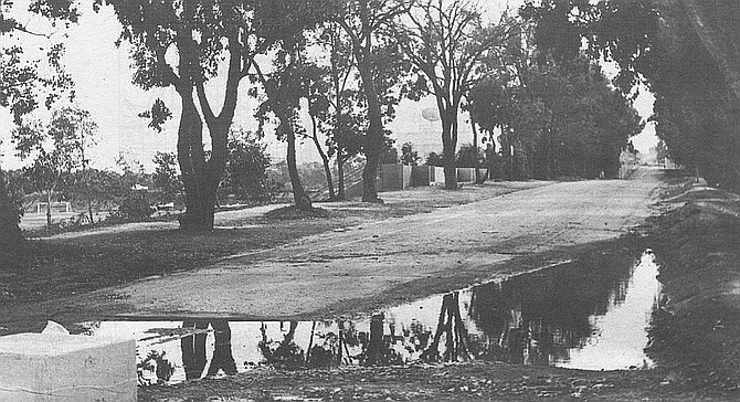
Northview Drive (Old Highway 101) after rain
When UCSD first opened, the old Pacific Coast Highway, US 101, had not yet been replaced by the long-promised Interstate 5. Although 101 sliced the campus in two, this did not create much of a problem; in its early days, UCSD was mostly confined to the Revelle College area, west of the highway. When the I-5 freeway opened (1965), the university found new uses for the old 101. In the south-central part of the campus, it became the main entrance, Gilman Drive. In the center of UCSD, 101 was gradually turned into footpaths that now' run past Third College and Mandeville Auditorium. And at the northern end of campus, old 101 became Northview Drive, the northern entrance to UCSD.
Except for the block-long section near North Torrey Pines Road, Northview Drive hasn’t been a drive in years. A decade ago, the road was blocked with a guardhouse and concrete pillars. Today it’s a seldom-used, never-repaired walkway of crumbling asphalt. The photograph shows it as it looked after this January’s rains.
Old Torrey Pines Road/Camp Callan Roads — UCSD, near Revelle College
Torrey Pines Road used to run north-northeast through the present site of Revelle College, merging with Route 101 (now Gilman Drive) near the center of campus. In the early 1960s, city engineers closed off this old road and rerouted it around UCSD’s western perimeter, where it finally met the old 101 route (a.k.a. North Torrey Pines Road) at the extreme northern end of the campus.
All of this rerouting left a lot of “dead” roads in the southwest corner of campus. Besides the old Torrey Pines Road, the area was laced with narrow, curvy streets left over from a Second World War Army camp, Camp Callan.
The anarchist assemblage of barracks that now goes by the name of the Che Cafe.
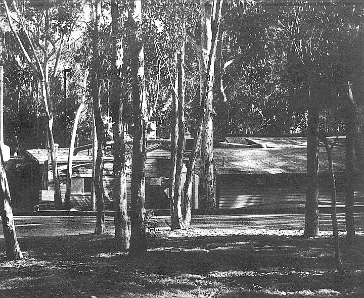
Most of the Camp Callan roads (including the main one, Camino Callan) have been subsumed into parking lots, service roads, and walkways in the Revelle College area. As for the camp's buildings, they were mostly destroyed. But several of them were shoved together near the old Torrey Pines Road and used in the 1960s as an improvised student center.
There have been two new student centers since that original one, each grander than the last. But neither of them had the style or cachet of the first, an anarchist assemblage of barracks that now goes by the name of the Che Cafe.
In the picture we see a western elevation of the historic cafe, looking not unlike a Hollywood depiction of a Hitler headquarters in East Prussia.
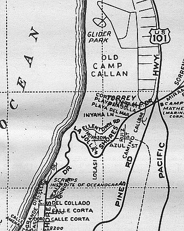
The Great Crossroads: Route 101, Torrey Pines Road, La Jolla Shores Drive, Miramar Road UCSD
In 1959 a portion of the city’s Pueblo Lands was deeded to the state for the campus of UCSD. In the center of this parcel lay a five-way intersection. Three main roads met US 101: Miramar from the east, La Jolla Shores from the west, and Torrey Pines from the southwest. A short distance away, two smaller roads met Miramar: Sorrento Road and John Jay Hopkins Drive. In addition to all of these were the networks of streets and drives left over from two military camps, the Army’s Camp Callan and the Marine Corps’s Camp Matthews.
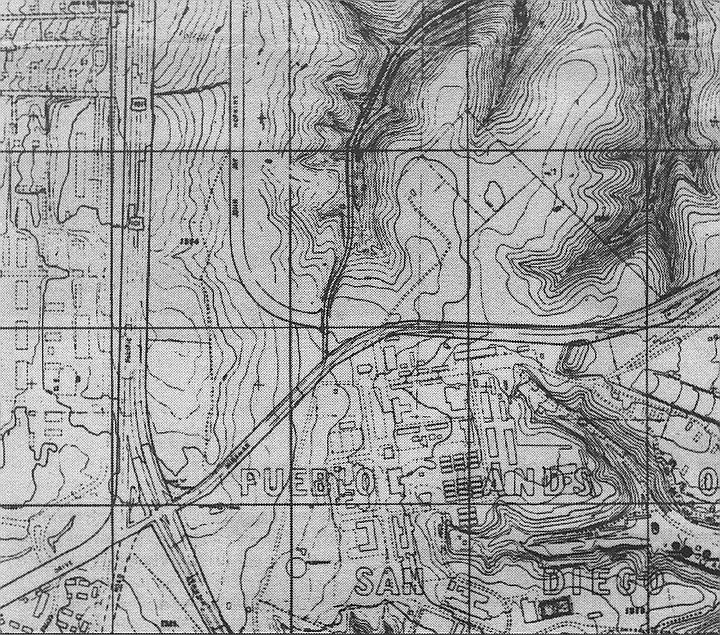
Pueblo lands
That this was a gem of a place in which to plonk down a new college may be seen from the fact that nearly all of the old Camp Matthews streets and buildings — even the Quonset huts — are still in daily use at UCSD. (The Marines left in ’64.) So are most of the roads, although many of them have been turned into walkways.
Nearly all of the old Camp Matthews streets and buildings — even the Quonset huts — are still in daily use at UCSD.
Such is the case today at the Great Crossroads. Bikes and pedestrians abound, but autos have no place to go except around a traffic island (left over from a fork in old Route 101) or into a parking lot. The old La Jolla Shores Drive here is nothing but a sidewalk; so are the former Miramar Road, Torrey Pines Road, and much of old 101.
The Great Crossroads. Bikes and pedestrians abound, but autos have no place to go except around a traffic island.
Visitors and students alike complain of disorientation and a sense of anomie when they’re walking through the central campus. The “spaceship” central library was supposed to provide an orienting landmark, but it looks the same from all sides, so it just adds to the confusion.
Putting back the street signs for the former highways would go a long way to solving the UCSD direction problems. It would also help give one a sense of place. “C’mon, Feng-shui — let’s take a stroll up 101 and grab a slice of pizza!”

Miramar Road began at Route 101, headed northeast through the present site of the UCSD Price Center.
Miramar Road — UCSD
Thirty years ago, Miramar Road began at Route 101, headed northeast through the present site of the UCSD Price Center, then continued southeast and east along the northern border of Miramar Naval Air Station. Today its westernmost segments have been turned into: 1) Old Miramar Road and walkways on the UCSD campus; 2) a smidgen of Genesee Avenue; 3) Eastgate Mall, in the Golden Triangle region.
La Jolla Village Drive was created in the 1960s as a realignment of Miramar Road. The new road got a new name because at that time the original Miramar Road still existed in the UCSD area. Presumably the “La Jolla” nonsense was dreamt up to make the scrubby surroundings sound classier than they were.
If there’s any justice in San Diego, La Jolla Village Drive will someday drop its cumbersome and pretentious moniker. After all, it’s not in La Jolla, it doesn’t pass through any villages, and it’s very confusing for westbound motorists on Miramar Road to discover suddenly that the road they’re on has changed names.
Sorrento Road provided the only direct route from the two nearby military bases to the railroad depot in Sorrento Valley.
Sorrento Road, UCSD to Sorrento Valley
Sorrento Road came into being around the Second World War, when it provided the only direct route from the two nearby military bases to the railroad depot in Sorrento Valley. A two-lane strip of asphalt laid at the bottom of a canyon, Sorrento Road was utilitarian rather than scenic. It closed for good in the mid-’60s, when the new Interstate 5 took the same canyon route between Genesee Avenue and Sorrento Valley.
Sorrento Road began on level ground at old Miramar Road (just south of the central library at UCSD — see photo) and headed northeast for about two miles, ending finally within 100 yards of the Santa Fe tracks at Sorrento Station.
The off-ramp from I-5 to Sorrento Valley Road follows the same canyon grade as the old Sorrento Road.

Smilax Road in Sorrento Valley is one in a series of short roads named for local flora.
Smilax Road — Soledad Canyon, Sorrento Valley
According to the dictionary, smilax is “any of a number of related, usually prickly, woody vines, including the sarsaparilla.” Further research shows that Smilax is a trade name for sarsaparilla extract sold by the Bios corporation in Santa Barbara and that there is still extant an old road in Vista and San Marcos called Smilax Road.

Sorrento Valley station
There was also once a Smilax Road in Sorrento Valley, one in a series of short roads named for local flora. It paralleled the railroad tracks on their south side, but now it’s gone, the victim of freeway building in the 1960s. In its stead there’s another road, nearer the tracks, named Roselle Street.
Sorrento Road used to end near Smilax Road. You’ll find Smilax on maps made between 1945 and 1965.
Eidelweis Street — Sorrento Valley
Here we are at ground level, under the freeway span in the very crotch of the so-called 5-805 merge. Eidelweis Street, or Edelweiss Street, is the road that crosses the railroad tracks in Sorrento Valley. On the north side of the tracks it turns into Sorrento Valley Boulevard.

Passersby and businesspeople in the area say they’ve never heard of Edelweiss.
Eidelweis Street has appeared on local maps for 70 years. It’s still shown (Edelweiss spelling) in the Thomas Bros, guide. But there isn’t a single street sign for it. And passersby and businesspeople in the area say they’ve never heard of it. When asked, they’ll identify the street at the railroad crossing as Sorrento Valley Boulevard.
One stranger, in a nearby racquetball club, says he wishes there were an Eidelweis Street about. “Everything around here is Sorrento Valley this, Sorrento Valley that.”

By 1970, Truckee Road had vanished from the books. In its place we now find a pair of short cul-de-sacs named for two British MPs of the early 20th Century: Balfour Court and Belloc Court.
Truckee Road — Pacific Beach, Northeast
Most of the Lost Roads in this series still endure as footpaths, parking lots, or slices of newer highway; but Truckee Road never existed at all, except on paper. Old maps and city directories show that it was supposed to begin near Los Altos Way in Pacific Beach and proceed due east, terminating about a quarter-mile west of todays Interstate 5.
In the early 1920s, Truckee Road was part of a subdivision plan on the south foot of Mt. Soledad. But San Diego development hit the skids around 1926, and then a depression and a war came.
In the 1940s, a few hundred temporary war-workers’ houses cropped up nearby, along streets that had been paved in the ’20s but never developed. (These hillside prefabs, known as Los Altos Terrace, were pretty classy; from their front stoops you got a panoramic view of downtown, the harbor, and Mission Bay. They were designed by Frank Hope, Jr., who in the 1950s and ’60s would become San Diego’s premier architect of hospitals and office buildings.) After the war, these temporaries were carted off, and private housing took their place. By the late ’50s, most of eastern Pacific Beach had filled in, but the Truckee Road region remained unpaved, ungraded, and unsigned.
In 1961 the Truckee area still looked much as it had in the ’20s- a square mile of steep hills and scrub canyon, most of it city land because no private developers wanted it. But that year the city council voted to turn part of the area into a park, named in honor of a dead Mission Hills florist.

Developers put up pricey houses on two-acre lots, called in the landscapers, and sold the results as “estates on Mt. Soledad in La Jolla.”
After that, things happened fast in these rocky muirlands. Kate Sessions Memorial Park was open by 1964. Nearby, Soledad Mountain Road was completed, connecting eastern PB with La Jolla. Developers put up pricey houses on two-acre lots, called in the landscapers, and sold the results as “estates on Mt. Soledad in La Jolla.”

Belloc Court. Hilaire Belloc is the politician and writer best remembered for his kiddie verse, his travel books.
By 1970, Truckee Road had vanished from the books. In its place we now find a pair of short cul-de-sacs named for two British MPs of the early 20th Century: Balfour Court and Belloc Court. The juxtaposition of these two streets suggests a developer with a sense of humor. Arthur Balfour is the fellow best remembered for the 1917 Balfour Declaration, in which it was resolved that it would be a good thing to give Palestine to the Jews. Hilaire Belloc is the politician and writer best remembered for his kiddie verse, his travel books, and his belief that it was a lousy thing to give Palestine to the Jews.
None of which has anything to do with Mr. Truckee, an early 19th-century Indian guide. Pioneers of the Sierra honored him by naming a river, a lake, a town, and a plateau of meadows after him. Today, the two-fisted mountain town of Truckee, California, is still on the map (north of Lake Tahoe) and so is Truckee River. Truckee Meadows, though, has vanished under the city of Reno, Nevada. And Truckee Lake was long ago renamed Donner Lake, after the ill-fated wagon-train party that camped there in 1846-47.
When Truckee Road was wiped off the San Diego map, that freed up the name. And lo! today there is a tiny Truckee Avenue on the northern rim of Mission Valley, right in the shadow of the 805 freeway.
Ward Road — Normal Heights and Mission Valley
Speaking of the Donner Party: There’s never been a Donner Road in San Diego, but there’ve been lots of Donners. One of the sons of George Donner (died and consumed by the Truckee River in early 1847) sired a son who moved to Texas after the Civil War. Said son begat a son named Joe, who became a carpenter and eventually moved his family to San Diego, where he died in 1944. His widow Myrtle followed in ’66. Only then did the kinfolk go public with the noisome little family secret: yes, they were descended from those Donners.
Joe and Myrtle lived at 3760 Ward Road in Normal Heights. Their house was razed a few years ago to make way for one of those cheap, multiunit apartment buildings that have turned the area into what realtors nicely call a “transitional” or “mixed” neighborhood.
But if the neighborhood’s going, the street’s almost entirely gone. Fifty years ago, Ward Road was one of the city’s key thoroughfares, two miles long and a main route to Mission Valley and the north. Now all that’s left of it is two shabby residential blocks.
Decades ago, if you were downtown and wanted for some strange reason to go to Escondido or Riverside, your most direct route was via Ward Road, which crossed Friars Road, turned into Murphy Canyon Road, and finally joined with Linda Vista Road on Kearny Mesa. From there the Escondido — or Inland — Highway proceeded north.
Today, nearly all of Ward has been supplanted by a stretch of Interstate/State Route 15. The new freeway follows the old Ward Road grade, beneath the Adams Avenue overpass. Recent maps still identify this portion of 15 as Ward Road. (Take out your Thomas Bros, and see.)
When the Ward ranch was subdivided in the early 1900s, its driveway was joined to an old Mission Valley wagon trail and called Ward Road.
The photograph shows a dead-ended stump of Ward, hard by an I-15 offramp in Normal Heights. Until it was closed off around 1960, this piece of street took you underneath Adams Avenue and into Mission Valley. A sign at the barrier says NO DUMPING, but on a recent day the weed-choked roadside was filled with garbage and a broken-down yellow davenport.
Down near the Mission, off Camino del Rio North, you can find another stump of road bearing the name Ward.
The Wards themselves seem to have been a colorful lot. They included a father-son team of public officials who divided their time between San Diego and Tombstone, Arizona. During one of their extended excursions (c. 1883), the elder Ward got himself named sheriff of Tombstone, with his son as deputy. By 1891 the younger Ward, Will by name, was deputy sheriff in San Diego. A few years later he was styling himself a “rancher” and keeping both a downtown house and a spread northeast of the city.
When the Ward ranch was subdivided in the early 1900s, its driveway was joined to an old Mission Valley wagon trail and called Ward Road. The old driveway proved to be too crooked and narrow for automobile traffic, however. By 1920 the southwest terminus of Ward was moved to a straighter, wider road, originally named Reed Street.
Thus: the block of Ward that conjoins Cherokee Avenue in Normal Heights was originally Reed; and the teensy street that runs from East Mountain View Drive to the road in the photograph is the real Ward driveway, even though maps call it 38th Street.
If this sounds confusing today, think of how it must have been for the Donners.

Ward Rd. and Murphy Canyon. Descendants of the Donner party settled on Ward Road.
Murphy Canyon Road — Mission Valley, Kearny Mesa East
Until the teens of this century, Ward Road’s northern extension, Murphy Canyon Road, was little more than a cowpath. Then traffic increased, for a couple of reasons. One was the creation of the Lee Highway, a transcontinental southern route that stretched from Washington, D.C., to San Diego. The Lee route entered the city via El Cajon Boulevard; Ward Road provided a route to Mission Valley and the north.
The second new development was a 12,000-acre army installation, Camp Kearny, on Linda Vista Mesa. There were only two roads from downtown to this army camp, and Ward Road/Murphy Canyon Road was one of them. (The other route was Linda Vista Road, an old wagon trail that took its name from the mesa and would keep it even when the namesake became known as Kearny Mesa.)
Like Ward Road, Murphy Canyon Road has been gradually supplanted by the I-15 freeway. The first phase of building occurred in the early 1960s, when a new four-lane state highway went up a hundred yards east of the old road. For 30 years since, maps have identified this new road as Murphy Canyon Road. The old Murphy Canyon Road remained as a frontage road for business, primarily construction companies.
For the past decade, the “new” Murphy Canyon Road, now widened to ten lanes, has been generally known as I-15. Meanwhile, the old road, with slight reroutings and reconstructions, has blossomed into a business center. Up near the old road’s northern end, you now find industrial parks and mirrored office buildings that house, inter alia, the San Diego Business Journal and radio stations KSDO and KSON.
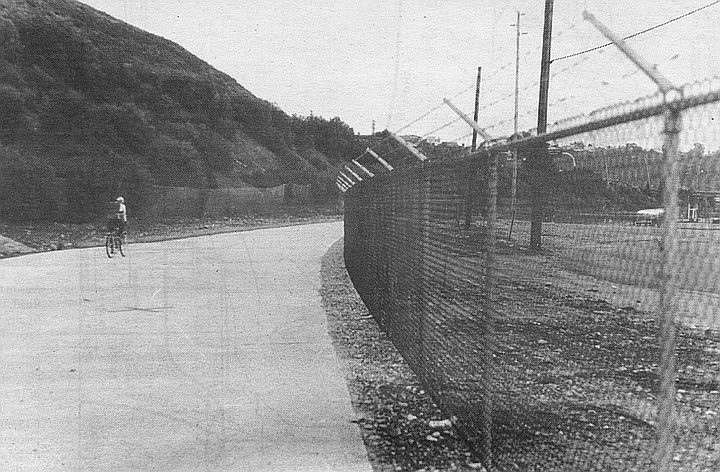
Bicycle path near southern end of Murphy Canyon Rd. Murphy was a pioneer rancher who acquired about a hundred acres of the old San Diego Mission land grant. By the time his widow put the spread up for sale in 1875, the 260 acres, was mostly filled with orange and almond groves.
The southern end of old Murphy Canyon Road used to intersect Friars Road near the Mission. Now it turns into a bicycle path a half-mile north of Friars.
Murphy Canyon, funnily enough, was named for Jack Murphy. Not the 1960s sports columnist who led the fight for a new ballpark, but a pioneer rancher who acquired about a hundred acres of the old San Diego Mission land grant. In the first county census (1860), John Murphy described himself as 26 years old, Irish-born, and a teamster by trade. By the time his widow put the spread up for sale in 1875, it had grown to 260 acres, most of them filled with orange and almond groves.
The two-story, wood-frame Murphy house stood on the west side of the canyon till the 1940s. Nowadays the old homestead is San Diego’s central petroleum-storage depot, a congeries of pipelines and oil tanks that march up the canyon floor behind Jack Murphy Stadium.
A relative, Charles Murphy, was a friend of the Wards of Ward Road. When the Ward father-and-son team moved to the Tombstone sheriffs office in 1883, Charley Murphy became “under sheriff’ of San Diego County. At other times he was city deputy constable, county road-tax collector, and a hose-truck driver for the fire department.
Fillmore Avenue, FIllmore Street — Hillcrest, South Mission Bay
Millard Fillmore, our 13th Chief Executive, was not only a man who appreciated cleanliness (he installed a running-water bathtub in the White House) and respected person property (he signed the Fugitive Slave Act) and understood the need to preserve our Anglo-Saxon heritage (he ran for President on the Know-Nothing ticket in 1856). Fillmore is also distinguished as the only U.S. President to have two San Diego streets named after him.
Fillmore and other national streets, on a 1925 Rodney Stokes map
Neither exists today under the Fillmore name. Brief histories of them both:
1) Fillmore Avenue. This was the original name of the thoroughfare that runs due east from University Avenue at Normal Street. Today it is designated as University Avenue. At the turn of the century, University Avenue (or Boulevard) turned northeast at this juncture — i.e., up Normal Street — then turned east again when it intersected Park Boulevard.

Fillmore Avenue, where it proceeded due east from University
In other words, what’s now called Normal Street and El Cajon Boulevard were formerly known as University Boulevard.

The way things were in 1903
This bit of information helps clear up some puzzling questions. For example, where the name University Avenue comes from. Originally, University Boulevard ran past the state normal school, or teacher’s college, which local boosters hoped would soon blossom into an honest-to-God university. (The state college later moved east, but its main building still stands near the corner of Normal and Park.)
Likewise, this history explains Normal Street and why a neighboring subdivision was called University Heights.
By 1910, Fillmore Avenue in Hillcrest had been renamed University Avenue, and the name Fillmore was up for grabs. City engineers soon assigned it to:
Where Fillmore Street was supposed to be: along Sea World Drive, about a quarter-mile east of Sea World Way
2) A proposed street in the mudflats south of Mission Bay. As the 1925 maps indicates, Fillmore Street ran SW-NE, following the same mid-19th-century street-grid orientation found in Old Town and Point Loma. If it were built today, it would be a causeway leading from Sea World Drive to Fiesta Island.
Fillmore Street remained on city engineering maps till the 1960s, when the city completed the southern portion of Mission Bay Park. In the 1920s, this muddy stretch was envisioned as a residential area, but today its only tenant is Sea World.
Achilles Drive — East San Diego
In the early 20th Century, the street plan of San Diego/East San Diego moved eastward at the rate of 20 blocks a decade. Occasionally the great moving grid ran into outlying settlements. At that point, some odd little driveway or cowpath would find itself suddenly incorporated into the city plan.
Such was the case with Achilles Drive, a tiny street that first appeared in East San Diego around 1910 and stayed on the map until the late ’60s. Now it’s incorporated into the school grounds of Wilson Middle School (formerly Woodrow Wilson Junior High School), on a large block between El Cajon Boulevard and Orange Street.

Achilles Drive, a tiny street that first appeared in East San Diego around 1910 and stayed on the map until the late ’60s. Now it’s incorporated into the school grounds of Wilson Middle School.
Early in this century, East San Diego was a separate municipality with its own city hall, schools, Carnegie Library, and street-naming systems. What’s now 37th Street in San Diego was then 3rd Street in East San Diego; the present 38th Street was known variously as 46th Street, Ward Road, and Thomas Avenue.
The main residential area of East S.D. lay between the trolleys of University Avenue and the east-west highway of El Cajon Boulevard. Achilles was created as a cozy two-block drive that lay between the busy boulevards of El Cajon and Orange Avenue. By 1920, one short block of Achilles Drive boasted four houses and a half-dozen garages and other outbuildings.

Looking eastward on Orange Avenue by Wilson Middle School. Achilles Drive ran perpendicular off Orange, at left-center in the photograph
During the next few years, San Diego and East San Diego revamped and coordinated their street-naming systems. (Examples: 44th Street in Normal Heights became Cherokee Avenue; 48th Street became 40th Street; Daley Avenue and Rexmore Drive in East San Diego became 39th Street.) In the course of all this, odd little roads like Achilles began to disappear. By 1940, Achilles was a one-block dogleg from Orange to 39th Street. Then, around 1970, the street disappeared altogether as its block was incorporated into the grounds of the neighboring public school.
The name Achilles is a mystery, although it presumably was a family name rather than a reference to the fellow with the heel.
Chestnut Street — Old Town
The short, straight street marked Presidio Drive, intersecting Taylor Street near Morena, is the last remnant of Chestnut Street.

The northwest block of Chestnut at Taylor had a strip of tourist cabins and a big lot for trailers.
A hundred years ago, Chestnut ran in a northwesterly direction from Witherby Street (Mission Hills area) to the Derby Dike by the San Diego River. At least it was supposed to. The two ends of Chestnut were graded and paved by the 1920s, but the middle section, representing the steep grade up the Presidio into Mission Hills, existed only in the mind of the mapmaker.

That northwest end of Chestnut vanished in the 1960s, when an I-8 freeway ramp was built on the site of the old trailer park.
When Presidio Park and the Serra Museum were created in the late 1920s, the Mission Hills end of Chestnut Street was renamed Presidio Drive.
In those days, Old Town was thick with tourist encampments. The northwest block of Chestnut at Taylor was one of the largest of these, with a strip of tourist cabins and a big lot for trailers.
That northwest end of Chestnut vanished in the 1960s, when an I-8 freeway ramp was built on the site of the old trailer park. All that remained of Chestnut Street was a hundred yards of asphalt leading to the Presidio Drive loop. By 1969, the only private address left on Chestnut Street was an architectural firm (still there, by the way), and no one objected when the city declared that Chestnut Street would thenceforth be known as Presidio Drive.
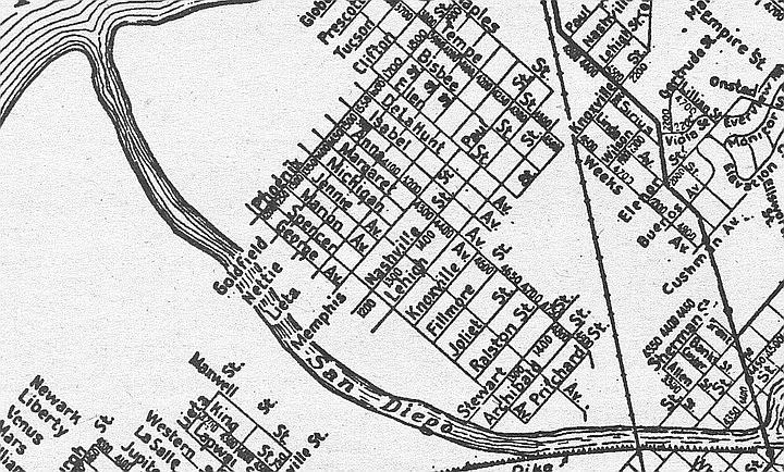
Nashville Street — Sports Arena Boulevard area
A half-century and more ago, Nashville Street was a thriving residential street in the mudflats south of Mission Bay. It began at the Mission Bay Causeway (later known as Midway Drive and now called Sports Arena Boulevard) and headed northeast for about eight blocks. Then it came to the pre-floodway San Diego River, skipped the river, and went on in the same direction for another few blocks.
Looking northeast, across Sports Arena Blvd. Freeway ramp occupies the former spot of Nashville Street.
One block of Nashville Street survives in the Bay Park area of town. The rest of the street has been obliterated by public works: the floodway, Mission Bay Park, and interstates 5 and 8.

Nashville was the “main drag” in the neighborhood during the 1930s and that locals called their enclave “Dutch Flats.”
In the Sports Arena Boulevard area, Nashville Street lasted till about 1970, when it was turned into an on-ramp for I-8. But its old residential neighborhood has somehow managed to endure. Ollie Street, on the other side of Sports Arena Boulevard, is still there, with its shabby prewar apartment buildings. So are Jupiter Street, LaSalle Street, and Western Street, which used to cross Nashville. Nashville’s sister street, Knoxville Street, is now called Channel Way.
In a letter to the Reader last September, former Nashville Street resident Ralph Willis reminisced that Nashville was the “main drag” in the neighborhood during the 1930s and that locals called their enclave “Dutch Flats.” Earlier, the term “Dutch Flats” referred to the entire isthmus between Mission Bay and the harbor.
Here's something you might be interested in.
Lost roads of San Diego
Whatever happened to Allen's Dairy Road, Harasthy Street, Liberator Street?
Lost roads of San Diego
Whatever happened to Allen's Dairy Road, Harasthy Street, Liberator Street?
Camino del Rio South. In July, 1982 city councilwoman Susan Golding and Pete Wilson aide George Gorton were robbed at gunpoint in the Lehr’s parking lot.
Author Margot Sheehan wrote for the Reader 1991-1993. She edited a satire page in 1991 called "San Diego Confidential." After she was let go from the Reader in 1993, Sheehan threatened litigation based on what she said was discrimination. In 2020, a writer using the name M.E. Burns wrote a eulogy for George Mitrovich, San Diego’s infamous political gadfly, and in 2023 under the name Meg Burns, appeared an obituary for Colin Flaherty, a former writer for the Reader and son-in-law of Congressman Lionel Van Deerlin. Both stories had earmarks of Margot Sheehan's writing.
Allen's Dairy Road
Mission Hills is a real enclave, accessible from downtown or Mission Valley only by roundabout routes. Seventy years ago, developers didn’t want any trunk roads through this new, genteel neighborhood; near its western perimeter lay tawdry commercial strips and the muddy Mexican slum of Old Town.
Allen's Dairy Road. The Allen kids buried the body of a Model T somewhere along the road in the 1930s.
Residents have maintained this insularity ever since. For example, in the early 1940s, the city wanted to build a Washington Street extension through Mission Hills to the Pacific Highway. The locals balked at the notion or a new highway cutting the neighborhood in two. So the proposed route ended up bypassing Mission Hills entirely. It veered sharply to the southwest from Washington and Hawk streets, eventually meeting Pacific Highway at the bottom of a canyon. That’s how we got the steep Washington Street extension that runs past Gelato Vero Cafe.
And then there’s the matter of Allen’s Dairy Road, or Allen Road, as it’s called nowadays. It runs from Fort Stockton Avenue (next to Ron Kiefer’s Gourmet Deli)> all the way down to Mission Valley, a quarter mile east of the Presidio.
Leave your car and bike behind when you visit Allen Road. It’s a bonafide city street, but only the first hundred yards are paved. Therein lies our story:
In 1885 Mr. and Mrs. Sereno Allen arrived here from Kansas, went into the milk business, and raised 13 children. Their dairy prospered under sons Fred and Harvey, who owned two ranches in the valley, pioneered door-to-door delivery, and kept a retail shop in Hillcrest. It wasn’t till 1957 that Sereno’s grandson John Allen finally sold the Mission Valley spread and moved his cows to El Cajon.
Allen Dairy Road on a 1963 map
During the 1920s and ’30s, the Allens used to send their milk trucks up to Mission Hills and Hillcrest via the steep-canyon path near the dairy. “It was just a little dirt road that served the dairy, which was down on a two-lane dirt road down in Mission Valley,” recalls Chuck Barr, who grew up in Mission Hills during the ’20s and ’30s. “I knew some of the Allens; I remember Richard Allen — he was the smart one in the family, got out of the dairy business, went to Cal Tech. There’s a story that the Allen kids buried the body of a Model T somewhere along the road. In the early ’30s they had this Model T that they fixed up to aquaplane along Torrey Pines beach. Well, you know, the body got rusted. So what they did was get a new body and put it on the old engine. They left the rusted old body north end alongside the road down there, and I remember there was an awful stink about it, with neighbors complaining. They never moved it, so I guess it’s still there!”
In those days city maps called this milk-truck route Canyon Road (there was already an Allen Street, near Morena Boulevard). But Mission Hills residents always called the street Allen’s Dairy Road. When the other Allen Street was obliterated by floodway plans in the 1940s, the city officially designated the Mission Valley truck-path as Allen Road and made plans to grade and pave it.
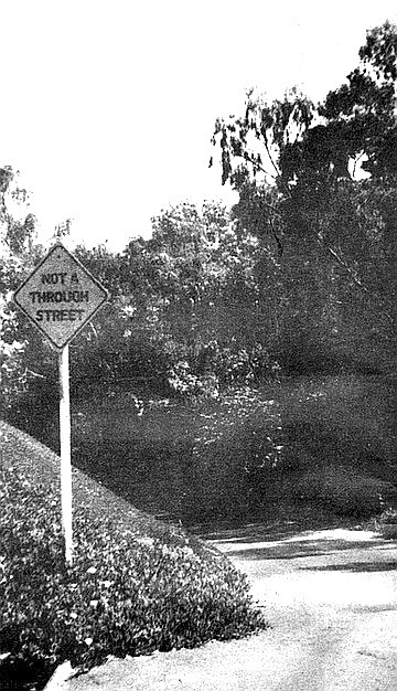
Mission Hills residents blocked the proposed improvement on Allen Dairy Road for 20 years.
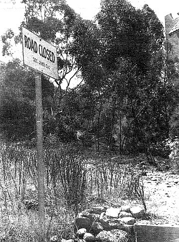
Mission Hills residents blocked the proposed improvement for 20 years. In the 1960s the city finally gave up and posted a sign at the Mission Valley end: Road Closed, per city vehicle code.
This northern end of Allen Road is now in the back lot of the Ramada Inn on Hotel Circle. A few motels to the east, where the dairy buildings once stood, we now have the Mission Valley Inn.
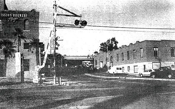
Harsathy Street — Middletown
Surely you remember Colonel Agostin Haraszthy, the Hungarian-born city father who was our first sheriff in 1850 and built the first jail (his first prisoner, Roy Bean, is said to have escaped within an hour by digging his way out with a penknife). No? Come on, you must know Haraszthy, that blackguard who was later accused of embezzling at the San Francisco mint, helped start the California wine industry, and was finally eaten by alligators in Nicaragua!
Haraszthy! The man who founded Middletown and even had a street named after him!
Not too many people do remember the old adventurer, nor did they 40 years ago, when the city wiped Harasthy [sic] Street off the map.
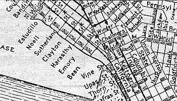
Harasthy Street on 1925 map
The street itself is still there, it just goes by another name — Washington Street. Part of it stretches for two and a half blocks from Kettner to Pacific Highway; the remainder is used as a drive by the Convair plant at Lindbergh Field.
Haraszthy was our first sheriff in 1850 and built the first jail – his first prisoner, Roy Bean.
Harasthy Street was laid out and named in the mid-19th Century, one of many short streets that ran east-west in the vicinity. Its parallel neighbors are named for Colonel Haraszthy’s contemporaries — Bean, San Diego’s first mayor (and Judge Roy Bean’s brother); Sutherland, San Diego’s first lawyer; Clayton, the first county surveyor; Emory, hero of the battle of San Pasqual. Their stumpy little streets survive, but only just barely. Sutherland, two blocks north of the Mission Brewery, is no more than a parking lot, though it still gets a street sign. Clayton Street doesn’t even rate a sign.
The misspelling of Colonel Haraszthy’s name seems to be a mapmaker’s error. When county surveyor James Pascoe laid out the first authoritative map of San Diego in 1870, he spelled the street Harasthy; and Harasthy it remained.
Harasthy Street’s brightest hour came at the end of World War'll, when the city opened its new “Washington Freeway,” a short concrete highway built to provide quick access between the Pacific Highway and Route 80 (El Cajon Boulevard). After nearly a century of being a forgotten side street, little Harasthy was now one of the main drags in town.
But motorists found it all too confusing. They’d drive straight down Washington, pass the Mission Brewery building, and then suddenly discover they were on this other street with an unpronounceable name. In 1952, Harasthy was redesignated West Washington Street.
At the corner of California Street and old Harasthy, the San Diego Trolley people plan to open a station in 1995. Its name: Washington Station. Surely poor Colonel Haraszthy deserves better.
Buchanan Avenue — University Heights/Mission Cliffs
Named after the saddest of Democrats, it’s one of the saddest streets in town.
You need a good grounding in 19th century American history to explain the street names that occur on the southwest fringes of University Heights, where that turn-of-the Century subdivision meets Hillcrest. Some are easy enough: Johnson Street, Hayes Street, Cleveland Street, Tyler, Polk, Van Buren, and Garfield streets — presidents all. But whatever were they thinking of when they came up with Blaine Street, named for the GOP nominee who lost the presidency to Grover Cleveland in 1884? The street namers must have been Republicans.
And then there’s Buchanan Avenue. Named after the saddest of Democrats, it’s one of the saddest streets in town.
Buchanan on 1925 map
How sad? It’s a canyon path covered with weeds. No one is ever recorded to have built so much as an outhouse there. But Buchanan Avenue still appears on the Thomas Bros, maps of San Diego.
Buchanan Avenue was laid out as University Heights’s only direct approach to Mission Valley. When contractors paved the local streets in the early 1920s, they left a 50-foot gap in the walk along Johnson Street. This is where Buchanan Avenue was supposed to fork off from Johnson. Seventy years later, the gap is still there. Beyond it lies the ridge of a canyon that meanders north and northwest to Mission Valley.
Mission Cliffs “It’s nice and quiet up here."
You can see a bit more evidence of a road at Buchanan’s northern end. Go down into Mission Valley and park in the lot of the Holiday Spa. At the southern end of the lot you’ll find a one-lane dirt-and-gravel path that leads you southeast for 200 yards, then forks into two dirt roads. On the left, leading north, you have the remnant of Massachusetts Avenue, a short, paved stump of which still thrives in Mission Cliffs. The right fork, leading southeast, is Buchanan Avenue, vanishing quickly into weeds and rubble.
Why weren’t these canyon roads ever finished? An old timer in Mission Cliffs says, “It’s nice and quiet up here. Don’t want strangers driving by all the time.”
Anna Avenue — Morena Area
In 1950 Santa Fe raised its trackbed, cutting Anna in two.
Anna Avenue nestles among thoroughfares named for 19th-century generals — Grant Street, Custer Street, Sherman Street —- so you might suppose that the street is a tribute to the mid-century Mexican dictator General Santa Anna. Actually, Anna is very much a girl, the sole survivor of a trio of sister streets laid out at the turn of the century near the southeast corner of Mission Bay. Isabel Street, to the northeast, and Margaret Street, to the southwest, were stillborn: planned but never developed or paved.
Anna on 1925 map
Little Anna thrived and grew, eventually crossing the Santa Fe railroad tracks and meeting up with Sherman Avenue. When the Pacific Highway opened in 1933, Anna was the access route between the businesses on the old Route 101 (Morena Avenue) and the new highway. Around the same time, an airfield called Peik Airport started up near Mission Bay, just north of the present-day Highway Patrol headquarters. And the main road to Peik Field — in fact, the only road — was Anna Avenue.
By the start of World War II, Anna was a wonder. You could walk its entire length in 15 minutes, yet go from a railroad freight yard to a major U.S. Highway to an airport. But Peik Field shut down during the war, and a few years later (1950) Santa Fe raised its trackbed, cutting Anna in two. The worst blows came in the ’50s and ’60s, when Mission Bay Park and Interstate 5 buried all of Anna west of Pacific Highway.
Two stumps of Anna remain today, bisected by the train tracks. The western one serves as a frontage road for businesses along Pacific Highway. The eastern stump, by the San Diego Humane Society, is not even marked by a street sign.
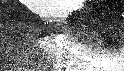
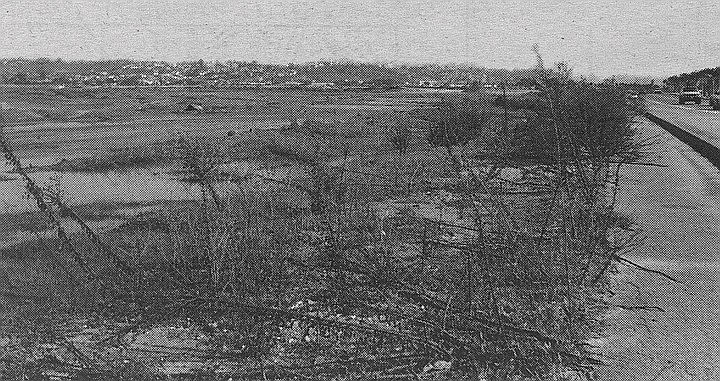
Route 101: “Suicide Alley” — Morena Area
Any local who had a driver’s license a generation ago can tell you about “Suicide Alley,” a stretch of the Pacific Highway just north of the Flood Control Channel. It was built in 1933, when the Morena Avenue route of U.S. 101 was being replaced by a new concrete highway to the west.
The bridge had been built to accommodate narrow-body flivvers of the early ’30s, and its four lanes were scarcely wider than a two-lane freeway of the 1950s.
Thirty-odd years ago, this was the worst freeway bottleneck in the county. See the concrete bridge in the photo? The highway approached this structure in a shallow curve and then suddenly narrowed: the bridge had been built to accommodate narrow-body flivvers of the early ’30s, and its four lanes were scarcely wider than a two-lane freeway of the 1950s.
In the mid-’60s the state bypassed this bottleneck by building an overpass extension that curved to the northwest, re-connecting with Route 101 near Mission Bay, and finally terminating at Sea World Drive (then called South Mission Bay Drive or the Sunset Cliffs Boulevard extension). In 1969 the bridge was bypassed again by the newly opened Interstate 5.
Today this 300-yard section of highway and bridge is a frontage road for the Pacific Highway. It dead-ends suddenly at a storage warehouse.
Sharp-eyed 101-watchers will note that the bridge pictured has identical siblings elsewhere in town: on Mission Bay Drive in Pacific Beach and on North Torrey Pines Road, just south of Del Mar.
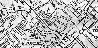
Convair Street, Vultee Street — Sports Arena Area
In 1944, the land between Midway Drive and Sports Arena Boulevard (then Frontier Street) became honey-combed with the short streets of a wartime housing project. After the war-workers went home, a motley collection of transients lived in the area. One was young Barbara Wood Graham, a fleet-following party girl who died in the electric chair in 1955 (Susan Hayward won an Oscar for playing her in I Want to Live!). Another was the brilliant German scientist Arthur Rudolph, whose Saturn rockets took us to the moon.
Looking south on Convair Street near its intersection with Liberator Street (now called East Street)
The Frontier housing project was closed in the early ’60s, and most of its streets obliterated. Liberator Street, named for the B-24 bomber, is now called East Street, a shopping-center route that runs by a Target outlet. Dartmouth Street is now a parking-lot drive in front of Home Depot; Convair Street, where they park the shopping carts for Ralphs supermarket.
Loma Portal, 1963
Vultee Street is today nothing more than parking spaces for one of those huge lots across from the Sports Arena. This photo is taken from the approximate spot of 3203 Vultee Street, where Dr. Rudolph lived with his family from 1946 to 1947.
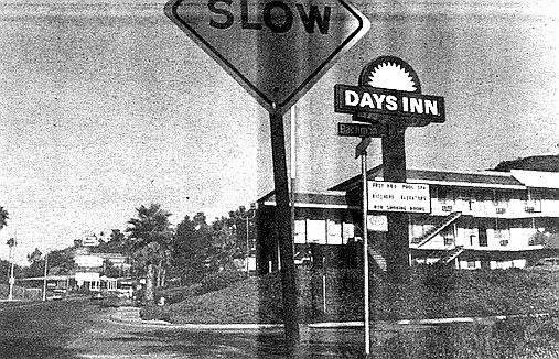
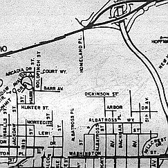
Homeland Place — Mission Valley
Savvy drivers in Mission Valley and Hillcrest know all about Bachman Road. It’s that semi-secret, semi-private canyon drive just west of the I-8-Route 163 interchange. Bachman connects Hotel Circle South with Bachman Place in Hillcrest and allows you to get from Mission Valley to Washington Street without getting on the freeway.
You’re not supposed to use Bachman Road unless you’re an employee of the UCSD Medical Center.
Trouble is, you’re not supposed to use Bachman Road unless you’re an employee of the UCSD Medical Center. UCSD took over this right-of-way in the mid-’80s in order to have an access road to their parking garage on Pill Hill.
Non-legit users of Bachman hardly ever get caught or fined. If security guards ask you for your ID, you can just say you’re lost, and they’ll happily show you the way out.
1957 map
If you’re in a belligerent mood, though, you may wish to insist that you have an easement to use the road. After all, the portion of Bachman in Mission Valley was for decades a city street called Homeland Place, a cul-de-sac that primarily served one of the local dairies. And at the Hillcrest end of the road is another city street, Bachman Place.
You might point out that you’ve been driving up this canyon every day for the last 50 years, and it’s not your fault if these Medical Center whippersnappers have gone and built themselves a parking garage near two of your favorite roads!
Maple Canyon Road — Bankers Hill/Hillcrest
In the days before I-5 tore the city core asunder with its S-curve, traffic along El Prado in Balboa Park was a problem. Motorists would commonly cut across Laurel Street and drive through Balboa Park to get to their destinations. In the late ’50s, the city proposed a “Laurel Street bypass” to end the east-west congestion.
The city found that it didn’t have the money to build tunnels under Quince or new bridges over the Cabrillo Freeway.
The traffic planners wanted a limited-access highway that wouldn’t disrupt existing streets. By happy circumstance, there was a deep canyon just north of Laurel Street, and it was here that they proposed to begin their new bypass.
Maple Canyon Road, as the project came to be called, was to run along the canyon floor from Laurel and Columbia and then emerge to join with Third Avenue near Redwood Street The bypass route would continue up Third, turn east on Upas, cut through the park, overpass the Cabrillo Freeway, and finally end at Robinson Street near Park Boulevard.
Preliminary survey and design work on the road began in 1960 and continued for several years. Hillcrest residents shot down the Upas Street route, so the city proposed an alternative: build a tunnel under Quince Street, from Third Avenue to the park.
The Maple Canyon Road idea finally died in 1963, when the city found that it didn’t have the money to build tunnels under Quince or new bridges over.Cabrillo Freeway. But city traffic was tapering off by then anyway; San Diego had gone into an economic tailspin and thousands of people were moving out of town.
By the time the city’s economy recovered in the late ’60s, new freeways and traffic patterns had mooted the question of a Laurel bypass.
In the end, the Maple Canyon Road project was a good thing for the Banker Hill area. It prevented development of the canyon area during the ’50s and ’60s, when cheap apartment buildings were springing up on nearby Reynard Way. Maple Canyon between Brant Street and Third Avenue remains one of the most secluded and bucolic spots in the city.
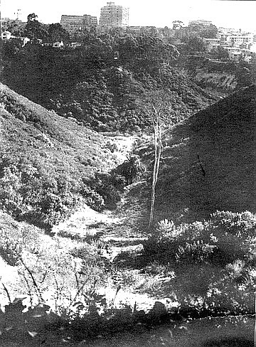
Camino del Rio South — Mission Valley, between Texas Street and Interstate 805
No other road in San Diego has seen as many name changes as the old Mission Valley Road. Seventy years ago the city decided to fancy up the two-lane dirt byway by renaming it “Camino del Rio.” The name never quite took; locals and newspaper stories alike persisted in calling it Mission Valley Road till the 1960s.
Camino del Rio South. The Caminos are the real thing — the same two-lane, winding Mission Valley Road that the farmers used 50 or 100 years ago.
In 1949 an extension was built east of Mission Gorge Road and titled the Alvarado Freeway. A couple of years later, the western half of Mission Valley Road was regraded and paved into a four-lane highway. In the late ’50s, Alvarado Freeway and Mission Valley Road/Camino del Rio were designated U.S. Highway 80. (Until then, U.S. 80 followed El Cajon Boulevard, Normal Street, and Washington Street as far as the 395 connector. Today these streets are an T8 business loop.)
Finally, in the 1960s, the road was renamed Interstate 8.
Today’s Camino del Rio South and Camino del Rio North are mostly frontage roads built from scratch in the early ’50s. Just east and west of Texas Street, however, the Caminos are the real thing — the same two-lane, winding Mission Valley Road that the farmers used 50 or 100 years ago.
The photograph shows a portion of the road near the 805 interchange. Hemmed in by a steep grade to the south and I-8 to the north, this portion of Camino del Rio South has never bustled with roadside businesses. In the 1970s, a restaurateur built a huge crystal-palace structure on the north side of the road. It soon went under, as did the three restaurants that followed. The last failure was Tijuana Tilly’s; the current occupant is something called Banx.
In 1982, the restaurant-of-the-moment was an upscale eatery called Lehr’s Greenhouse, and the parking lot was rumored to be a good place to score an ounce of cocaine. In short order, street crime arrived in this out-of-the-way pocket of Mission Valley. The most famous incident occurred in July of that year, when city councilwoman Susan Golding and her companion, Pete Wilson aide George Gorton, were robbed at gunpoint in the Lehr’s parking lot.
It’s not the Santa Fe Railway that abolished California Street. The trolley folks at MTDB are the culprits.
California Street — Downtown
In case you didn’t notice, we lost a historic downtown street just recently. Toward the end of 1992, most of the street signs for California Street came down. We shall not see them again. California Street, that slummy 19th-century drive on the west side of the railroad tracks, is gone for good, and the only reminders left us are stenciled notices from the Santa Fe Railway:
NOTICE
THIS IS NOT A PUBLIC HIGHWAY
IT IS THE PROPERTY OF THE
A.T.&S.F. RY. CO.
Actually, it’s not the Santa Fe Railway that abolished California Street. The trolley folks at MTDB are the culprits. In the process of improving the track bed, they had to obliterate the one narrow access road to the tracks that form the route for the northbound Old Town branch of the trolley. That branch reached Harborview (Cedar Street) last year and is scheduled to arrive at Washington Street in 1995.
California Street on 1925 map
California Street became the street-beside-the-railroad-tracks around 1885, just before the first Santa Fe depot opened. In those days, California Street ran right alongside, or very close to, the harbor. Now it’s a bit more inland, thanks to a century of landfills that have made possible such wonders as Pacific Highway, Harbor Drive, and the County Administration Building.
Hemmed in by the railroad right of way, California Street never got very wide or stylish. By the turn of the century it had acquired a low-rent, back-alley air and boasted mainly transients’ shacks and rooming houses. Even today many nearby blocks in the Harborview area offer a distinct whiff of early 20th-century squalor.
Contrast California’s story with that of Arctic Street, its parallel neighbor to the east. Arctic Street had a trolley line running down its middle and became a favored business address for auto dealers and furniture showrooms. Eventually Arctic became Kettner Boulevard. Kettner lost its trolley line, but it still bustles.
North of Vine Street, the tracks and California Street diverge. You can still find a couple of California Street signs in Middletown (near Cousins Warehouse) and in Old Town.
“They changed the name of the whole street to University, and now hardly anyone remembers about Douglas Street. It’s a shame.”
Douglas Street — Hillcrest/Mission Hills
The city’s biggest road project of the Second World War years was the so-called Douglas Street Connector, a stretch of highway that linked Mission Hills/Hillcrest with Pacific Highway and the Consolidated Vultee plants near Lindbergh Field. Today we know the Connector as that steep Washington Street grade running past the Gelato Vero coffeehouse on India Street.
The main casualty of the Douglas Street Connector was Douglas Street itself. It was an eight-block-long residential street running east-west between Albatross and Jackdaw, delightfully isolated by canyons at both ends. This isolation ended when Douglas Street was linked to University Avenue at its eastern end, to the Connector at its western.
Douglas Street on 1925 map
“They filled in the canyon between Douglas Street and University and built a road across it,” recalls Eleanor Meadows, a San Diego native whose father built many of the Craftsman-style bungalows in the area. “They changed the name of the whole street to University, and now hardly anyone remembers about Douglas Street. It’s a shame.”
Which Douglas the street was named for is unclear. On maps printed before the 1920s, the name is “Douglass,” which seems clearly to refer to Frederick Douglass, the onetime slave and champion of Negro emancipation. Later maps spell it “Douglas,” suggesting statesman Stephen A. Douglas.
When the time came to name the Douglas Street Connector, no one thought to retain the name Douglas Street. In 1944 public works director Fred Rhodes and city planner Glenn Rick held a naming competition for the new artery. Some of the entries, as recorded in the San Diego Daily Journal: Hi-Five, Victory Way, Silvergate Freeway, Convair Way, Father Horton Road, Fifth Bond Drive, Boulevard of the Allies. A few spoilsports suggested it simply be named University Avenue or El Cajon Boulevard. In the end “Washington Freeway” won out, though the “Freeway” part never really caught on. And poor Douglas Street is now popularly known simply as “that narrow part of University Avenue that runs past Vons.”
Old Route 101, Northview Drive — UCSD, north end
Northview Drive (Old Highway 101) after rain
When UCSD first opened, the old Pacific Coast Highway, US 101, had not yet been replaced by the long-promised Interstate 5. Although 101 sliced the campus in two, this did not create much of a problem; in its early days, UCSD was mostly confined to the Revelle College area, west of the highway. When the I-5 freeway opened (1965), the university found new uses for the old 101. In the south-central part of the campus, it became the main entrance, Gilman Drive. In the center of UCSD, 101 was gradually turned into footpaths that now' run past Third College and Mandeville Auditorium. And at the northern end of campus, old 101 became Northview Drive, the northern entrance to UCSD.
Except for the block-long section near North Torrey Pines Road, Northview Drive hasn’t been a drive in years. A decade ago, the road was blocked with a guardhouse and concrete pillars. Today it’s a seldom-used, never-repaired walkway of crumbling asphalt. The photograph shows it as it looked after this January’s rains.
Old Torrey Pines Road/Camp Callan Roads — UCSD, near Revelle College
Torrey Pines Road used to run north-northeast through the present site of Revelle College, merging with Route 101 (now Gilman Drive) near the center of campus. In the early 1960s, city engineers closed off this old road and rerouted it around UCSD’s western perimeter, where it finally met the old 101 route (a.k.a. North Torrey Pines Road) at the extreme northern end of the campus.
All of this rerouting left a lot of “dead” roads in the southwest corner of campus. Besides the old Torrey Pines Road, the area was laced with narrow, curvy streets left over from a Second World War Army camp, Camp Callan.
The anarchist assemblage of barracks that now goes by the name of the Che Cafe.
Most of the Camp Callan roads (including the main one, Camino Callan) have been subsumed into parking lots, service roads, and walkways in the Revelle College area. As for the camp's buildings, they were mostly destroyed. But several of them were shoved together near the old Torrey Pines Road and used in the 1960s as an improvised student center.
There have been two new student centers since that original one, each grander than the last. But neither of them had the style or cachet of the first, an anarchist assemblage of barracks that now goes by the name of the Che Cafe.
In the picture we see a western elevation of the historic cafe, looking not unlike a Hollywood depiction of a Hitler headquarters in East Prussia.
The Great Crossroads: Route 101, Torrey Pines Road, La Jolla Shores Drive, Miramar Road UCSD
In 1959 a portion of the city’s Pueblo Lands was deeded to the state for the campus of UCSD. In the center of this parcel lay a five-way intersection. Three main roads met US 101: Miramar from the east, La Jolla Shores from the west, and Torrey Pines from the southwest. A short distance away, two smaller roads met Miramar: Sorrento Road and John Jay Hopkins Drive. In addition to all of these were the networks of streets and drives left over from two military camps, the Army’s Camp Callan and the Marine Corps’s Camp Matthews.
Pueblo lands
That this was a gem of a place in which to plonk down a new college may be seen from the fact that nearly all of the old Camp Matthews streets and buildings — even the Quonset huts — are still in daily use at UCSD. (The Marines left in ’64.) So are most of the roads, although many of them have been turned into walkways.
Nearly all of the old Camp Matthews streets and buildings — even the Quonset huts — are still in daily use at UCSD.
Such is the case today at the Great Crossroads. Bikes and pedestrians abound, but autos have no place to go except around a traffic island (left over from a fork in old Route 101) or into a parking lot. The old La Jolla Shores Drive here is nothing but a sidewalk; so are the former Miramar Road, Torrey Pines Road, and much of old 101.
The Great Crossroads. Bikes and pedestrians abound, but autos have no place to go except around a traffic island.
Visitors and students alike complain of disorientation and a sense of anomie when they’re walking through the central campus. The “spaceship” central library was supposed to provide an orienting landmark, but it looks the same from all sides, so it just adds to the confusion.
Putting back the street signs for the former highways would go a long way to solving the UCSD direction problems. It would also help give one a sense of place. “C’mon, Feng-shui — let’s take a stroll up 101 and grab a slice of pizza!”
Miramar Road began at Route 101, headed northeast through the present site of the UCSD Price Center.
Miramar Road — UCSD
Thirty years ago, Miramar Road began at Route 101, headed northeast through the present site of the UCSD Price Center, then continued southeast and east along the northern border of Miramar Naval Air Station. Today its westernmost segments have been turned into: 1) Old Miramar Road and walkways on the UCSD campus; 2) a smidgen of Genesee Avenue; 3) Eastgate Mall, in the Golden Triangle region.
La Jolla Village Drive was created in the 1960s as a realignment of Miramar Road. The new road got a new name because at that time the original Miramar Road still existed in the UCSD area. Presumably the “La Jolla” nonsense was dreamt up to make the scrubby surroundings sound classier than they were.
If there’s any justice in San Diego, La Jolla Village Drive will someday drop its cumbersome and pretentious moniker. After all, it’s not in La Jolla, it doesn’t pass through any villages, and it’s very confusing for westbound motorists on Miramar Road to discover suddenly that the road they’re on has changed names.
Sorrento Road provided the only direct route from the two nearby military bases to the railroad depot in Sorrento Valley.
Sorrento Road, UCSD to Sorrento Valley
Sorrento Road came into being around the Second World War, when it provided the only direct route from the two nearby military bases to the railroad depot in Sorrento Valley. A two-lane strip of asphalt laid at the bottom of a canyon, Sorrento Road was utilitarian rather than scenic. It closed for good in the mid-’60s, when the new Interstate 5 took the same canyon route between Genesee Avenue and Sorrento Valley.
Sorrento Road began on level ground at old Miramar Road (just south of the central library at UCSD — see photo) and headed northeast for about two miles, ending finally within 100 yards of the Santa Fe tracks at Sorrento Station.
The off-ramp from I-5 to Sorrento Valley Road follows the same canyon grade as the old Sorrento Road.
Smilax Road in Sorrento Valley is one in a series of short roads named for local flora.
Smilax Road — Soledad Canyon, Sorrento Valley
According to the dictionary, smilax is “any of a number of related, usually prickly, woody vines, including the sarsaparilla.” Further research shows that Smilax is a trade name for sarsaparilla extract sold by the Bios corporation in Santa Barbara and that there is still extant an old road in Vista and San Marcos called Smilax Road.
Sorrento Valley station
There was also once a Smilax Road in Sorrento Valley, one in a series of short roads named for local flora. It paralleled the railroad tracks on their south side, but now it’s gone, the victim of freeway building in the 1960s. In its stead there’s another road, nearer the tracks, named Roselle Street.
Sorrento Road used to end near Smilax Road. You’ll find Smilax on maps made between 1945 and 1965.
Eidelweis Street — Sorrento Valley
Here we are at ground level, under the freeway span in the very crotch of the so-called 5-805 merge. Eidelweis Street, or Edelweiss Street, is the road that crosses the railroad tracks in Sorrento Valley. On the north side of the tracks it turns into Sorrento Valley Boulevard.
Passersby and businesspeople in the area say they’ve never heard of Edelweiss.
Eidelweis Street has appeared on local maps for 70 years. It’s still shown (Edelweiss spelling) in the Thomas Bros, guide. But there isn’t a single street sign for it. And passersby and businesspeople in the area say they’ve never heard of it. When asked, they’ll identify the street at the railroad crossing as Sorrento Valley Boulevard.
One stranger, in a nearby racquetball club, says he wishes there were an Eidelweis Street about. “Everything around here is Sorrento Valley this, Sorrento Valley that.”
By 1970, Truckee Road had vanished from the books. In its place we now find a pair of short cul-de-sacs named for two British MPs of the early 20th Century: Balfour Court and Belloc Court.
Truckee Road — Pacific Beach, Northeast
Most of the Lost Roads in this series still endure as footpaths, parking lots, or slices of newer highway; but Truckee Road never existed at all, except on paper. Old maps and city directories show that it was supposed to begin near Los Altos Way in Pacific Beach and proceed due east, terminating about a quarter-mile west of todays Interstate 5.
In the early 1920s, Truckee Road was part of a subdivision plan on the south foot of Mt. Soledad. But San Diego development hit the skids around 1926, and then a depression and a war came.
In the 1940s, a few hundred temporary war-workers’ houses cropped up nearby, along streets that had been paved in the ’20s but never developed. (These hillside prefabs, known as Los Altos Terrace, were pretty classy; from their front stoops you got a panoramic view of downtown, the harbor, and Mission Bay. They were designed by Frank Hope, Jr., who in the 1950s and ’60s would become San Diego’s premier architect of hospitals and office buildings.) After the war, these temporaries were carted off, and private housing took their place. By the late ’50s, most of eastern Pacific Beach had filled in, but the Truckee Road region remained unpaved, ungraded, and unsigned.
In 1961 the Truckee area still looked much as it had in the ’20s- a square mile of steep hills and scrub canyon, most of it city land because no private developers wanted it. But that year the city council voted to turn part of the area into a park, named in honor of a dead Mission Hills florist.
Developers put up pricey houses on two-acre lots, called in the landscapers, and sold the results as “estates on Mt. Soledad in La Jolla.”
After that, things happened fast in these rocky muirlands. Kate Sessions Memorial Park was open by 1964. Nearby, Soledad Mountain Road was completed, connecting eastern PB with La Jolla. Developers put up pricey houses on two-acre lots, called in the landscapers, and sold the results as “estates on Mt. Soledad in La Jolla.”
Belloc Court. Hilaire Belloc is the politician and writer best remembered for his kiddie verse, his travel books.
By 1970, Truckee Road had vanished from the books. In its place we now find a pair of short cul-de-sacs named for two British MPs of the early 20th Century: Balfour Court and Belloc Court. The juxtaposition of these two streets suggests a developer with a sense of humor. Arthur Balfour is the fellow best remembered for the 1917 Balfour Declaration, in which it was resolved that it would be a good thing to give Palestine to the Jews. Hilaire Belloc is the politician and writer best remembered for his kiddie verse, his travel books, and his belief that it was a lousy thing to give Palestine to the Jews.
None of which has anything to do with Mr. Truckee, an early 19th-century Indian guide. Pioneers of the Sierra honored him by naming a river, a lake, a town, and a plateau of meadows after him. Today, the two-fisted mountain town of Truckee, California, is still on the map (north of Lake Tahoe) and so is Truckee River. Truckee Meadows, though, has vanished under the city of Reno, Nevada. And Truckee Lake was long ago renamed Donner Lake, after the ill-fated wagon-train party that camped there in 1846-47.
When Truckee Road was wiped off the San Diego map, that freed up the name. And lo! today there is a tiny Truckee Avenue on the northern rim of Mission Valley, right in the shadow of the 805 freeway.
Ward Road — Normal Heights and Mission Valley
Speaking of the Donner Party: There’s never been a Donner Road in San Diego, but there’ve been lots of Donners. One of the sons of George Donner (died and consumed by the Truckee River in early 1847) sired a son who moved to Texas after the Civil War. Said son begat a son named Joe, who became a carpenter and eventually moved his family to San Diego, where he died in 1944. His widow Myrtle followed in ’66. Only then did the kinfolk go public with the noisome little family secret: yes, they were descended from those Donners.
Joe and Myrtle lived at 3760 Ward Road in Normal Heights. Their house was razed a few years ago to make way for one of those cheap, multiunit apartment buildings that have turned the area into what realtors nicely call a “transitional” or “mixed” neighborhood.
But if the neighborhood’s going, the street’s almost entirely gone. Fifty years ago, Ward Road was one of the city’s key thoroughfares, two miles long and a main route to Mission Valley and the north. Now all that’s left of it is two shabby residential blocks.
Decades ago, if you were downtown and wanted for some strange reason to go to Escondido or Riverside, your most direct route was via Ward Road, which crossed Friars Road, turned into Murphy Canyon Road, and finally joined with Linda Vista Road on Kearny Mesa. From there the Escondido — or Inland — Highway proceeded north.
Today, nearly all of Ward has been supplanted by a stretch of Interstate/State Route 15. The new freeway follows the old Ward Road grade, beneath the Adams Avenue overpass. Recent maps still identify this portion of 15 as Ward Road. (Take out your Thomas Bros, and see.)
When the Ward ranch was subdivided in the early 1900s, its driveway was joined to an old Mission Valley wagon trail and called Ward Road.
The photograph shows a dead-ended stump of Ward, hard by an I-15 offramp in Normal Heights. Until it was closed off around 1960, this piece of street took you underneath Adams Avenue and into Mission Valley. A sign at the barrier says NO DUMPING, but on a recent day the weed-choked roadside was filled with garbage and a broken-down yellow davenport.
Down near the Mission, off Camino del Rio North, you can find another stump of road bearing the name Ward.
The Wards themselves seem to have been a colorful lot. They included a father-son team of public officials who divided their time between San Diego and Tombstone, Arizona. During one of their extended excursions (c. 1883), the elder Ward got himself named sheriff of Tombstone, with his son as deputy. By 1891 the younger Ward, Will by name, was deputy sheriff in San Diego. A few years later he was styling himself a “rancher” and keeping both a downtown house and a spread northeast of the city.
When the Ward ranch was subdivided in the early 1900s, its driveway was joined to an old Mission Valley wagon trail and called Ward Road. The old driveway proved to be too crooked and narrow for automobile traffic, however. By 1920 the southwest terminus of Ward was moved to a straighter, wider road, originally named Reed Street.
Thus: the block of Ward that conjoins Cherokee Avenue in Normal Heights was originally Reed; and the teensy street that runs from East Mountain View Drive to the road in the photograph is the real Ward driveway, even though maps call it 38th Street.
If this sounds confusing today, think of how it must have been for the Donners.
Ward Rd. and Murphy Canyon. Descendants of the Donner party settled on Ward Road.
Murphy Canyon Road — Mission Valley, Kearny Mesa East
Until the teens of this century, Ward Road’s northern extension, Murphy Canyon Road, was little more than a cowpath. Then traffic increased, for a couple of reasons. One was the creation of the Lee Highway, a transcontinental southern route that stretched from Washington, D.C., to San Diego. The Lee route entered the city via El Cajon Boulevard; Ward Road provided a route to Mission Valley and the north.
The second new development was a 12,000-acre army installation, Camp Kearny, on Linda Vista Mesa. There were only two roads from downtown to this army camp, and Ward Road/Murphy Canyon Road was one of them. (The other route was Linda Vista Road, an old wagon trail that took its name from the mesa and would keep it even when the namesake became known as Kearny Mesa.)
Like Ward Road, Murphy Canyon Road has been gradually supplanted by the I-15 freeway. The first phase of building occurred in the early 1960s, when a new four-lane state highway went up a hundred yards east of the old road. For 30 years since, maps have identified this new road as Murphy Canyon Road. The old Murphy Canyon Road remained as a frontage road for business, primarily construction companies.
For the past decade, the “new” Murphy Canyon Road, now widened to ten lanes, has been generally known as I-15. Meanwhile, the old road, with slight reroutings and reconstructions, has blossomed into a business center. Up near the old road’s northern end, you now find industrial parks and mirrored office buildings that house, inter alia, the San Diego Business Journal and radio stations KSDO and KSON.
Bicycle path near southern end of Murphy Canyon Rd. Murphy was a pioneer rancher who acquired about a hundred acres of the old San Diego Mission land grant. By the time his widow put the spread up for sale in 1875, the 260 acres, was mostly filled with orange and almond groves.
The southern end of old Murphy Canyon Road used to intersect Friars Road near the Mission. Now it turns into a bicycle path a half-mile north of Friars.
Murphy Canyon, funnily enough, was named for Jack Murphy. Not the 1960s sports columnist who led the fight for a new ballpark, but a pioneer rancher who acquired about a hundred acres of the old San Diego Mission land grant. In the first county census (1860), John Murphy described himself as 26 years old, Irish-born, and a teamster by trade. By the time his widow put the spread up for sale in 1875, it had grown to 260 acres, most of them filled with orange and almond groves.
The two-story, wood-frame Murphy house stood on the west side of the canyon till the 1940s. Nowadays the old homestead is San Diego’s central petroleum-storage depot, a congeries of pipelines and oil tanks that march up the canyon floor behind Jack Murphy Stadium.
A relative, Charles Murphy, was a friend of the Wards of Ward Road. When the Ward father-and-son team moved to the Tombstone sheriffs office in 1883, Charley Murphy became “under sheriff’ of San Diego County. At other times he was city deputy constable, county road-tax collector, and a hose-truck driver for the fire department.
Fillmore Avenue, FIllmore Street — Hillcrest, South Mission Bay
Millard Fillmore, our 13th Chief Executive, was not only a man who appreciated cleanliness (he installed a running-water bathtub in the White House) and respected person property (he signed the Fugitive Slave Act) and understood the need to preserve our Anglo-Saxon heritage (he ran for President on the Know-Nothing ticket in 1856). Fillmore is also distinguished as the only U.S. President to have two San Diego streets named after him.
Fillmore and other national streets, on a 1925 Rodney Stokes map
Neither exists today under the Fillmore name. Brief histories of them both:
1) Fillmore Avenue. This was the original name of the thoroughfare that runs due east from University Avenue at Normal Street. Today it is designated as University Avenue. At the turn of the century, University Avenue (or Boulevard) turned northeast at this juncture — i.e., up Normal Street — then turned east again when it intersected Park Boulevard.
Fillmore Avenue, where it proceeded due east from University
In other words, what’s now called Normal Street and El Cajon Boulevard were formerly known as University Boulevard.
The way things were in 1903
This bit of information helps clear up some puzzling questions. For example, where the name University Avenue comes from. Originally, University Boulevard ran past the state normal school, or teacher’s college, which local boosters hoped would soon blossom into an honest-to-God university. (The state college later moved east, but its main building still stands near the corner of Normal and Park.)
Likewise, this history explains Normal Street and why a neighboring subdivision was called University Heights.
By 1910, Fillmore Avenue in Hillcrest had been renamed University Avenue, and the name Fillmore was up for grabs. City engineers soon assigned it to:
Where Fillmore Street was supposed to be: along Sea World Drive, about a quarter-mile east of Sea World Way
2) A proposed street in the mudflats south of Mission Bay. As the 1925 maps indicates, Fillmore Street ran SW-NE, following the same mid-19th-century street-grid orientation found in Old Town and Point Loma. If it were built today, it would be a causeway leading from Sea World Drive to Fiesta Island.
Fillmore Street remained on city engineering maps till the 1960s, when the city completed the southern portion of Mission Bay Park. In the 1920s, this muddy stretch was envisioned as a residential area, but today its only tenant is Sea World.
Achilles Drive — East San Diego
In the early 20th Century, the street plan of San Diego/East San Diego moved eastward at the rate of 20 blocks a decade. Occasionally the great moving grid ran into outlying settlements. At that point, some odd little driveway or cowpath would find itself suddenly incorporated into the city plan.
Such was the case with Achilles Drive, a tiny street that first appeared in East San Diego around 1910 and stayed on the map until the late ’60s. Now it’s incorporated into the school grounds of Wilson Middle School (formerly Woodrow Wilson Junior High School), on a large block between El Cajon Boulevard and Orange Street.
Achilles Drive, a tiny street that first appeared in East San Diego around 1910 and stayed on the map until the late ’60s. Now it’s incorporated into the school grounds of Wilson Middle School.
Early in this century, East San Diego was a separate municipality with its own city hall, schools, Carnegie Library, and street-naming systems. What’s now 37th Street in San Diego was then 3rd Street in East San Diego; the present 38th Street was known variously as 46th Street, Ward Road, and Thomas Avenue.
The main residential area of East S.D. lay between the trolleys of University Avenue and the east-west highway of El Cajon Boulevard. Achilles was created as a cozy two-block drive that lay between the busy boulevards of El Cajon and Orange Avenue. By 1920, one short block of Achilles Drive boasted four houses and a half-dozen garages and other outbuildings.
Looking eastward on Orange Avenue by Wilson Middle School. Achilles Drive ran perpendicular off Orange, at left-center in the photograph
During the next few years, San Diego and East San Diego revamped and coordinated their street-naming systems. (Examples: 44th Street in Normal Heights became Cherokee Avenue; 48th Street became 40th Street; Daley Avenue and Rexmore Drive in East San Diego became 39th Street.) In the course of all this, odd little roads like Achilles began to disappear. By 1940, Achilles was a one-block dogleg from Orange to 39th Street. Then, around 1970, the street disappeared altogether as its block was incorporated into the grounds of the neighboring public school.
The name Achilles is a mystery, although it presumably was a family name rather than a reference to the fellow with the heel.
Chestnut Street — Old Town
The short, straight street marked Presidio Drive, intersecting Taylor Street near Morena, is the last remnant of Chestnut Street.
The northwest block of Chestnut at Taylor had a strip of tourist cabins and a big lot for trailers.
A hundred years ago, Chestnut ran in a northwesterly direction from Witherby Street (Mission Hills area) to the Derby Dike by the San Diego River. At least it was supposed to. The two ends of Chestnut were graded and paved by the 1920s, but the middle section, representing the steep grade up the Presidio into Mission Hills, existed only in the mind of the mapmaker.
That northwest end of Chestnut vanished in the 1960s, when an I-8 freeway ramp was built on the site of the old trailer park.
When Presidio Park and the Serra Museum were created in the late 1920s, the Mission Hills end of Chestnut Street was renamed Presidio Drive.
In those days, Old Town was thick with tourist encampments. The northwest block of Chestnut at Taylor was one of the largest of these, with a strip of tourist cabins and a big lot for trailers.
That northwest end of Chestnut vanished in the 1960s, when an I-8 freeway ramp was built on the site of the old trailer park. All that remained of Chestnut Street was a hundred yards of asphalt leading to the Presidio Drive loop. By 1969, the only private address left on Chestnut Street was an architectural firm (still there, by the way), and no one objected when the city declared that Chestnut Street would thenceforth be known as Presidio Drive.
Nashville Street — Sports Arena Boulevard area
A half-century and more ago, Nashville Street was a thriving residential street in the mudflats south of Mission Bay. It began at the Mission Bay Causeway (later known as Midway Drive and now called Sports Arena Boulevard) and headed northeast for about eight blocks. Then it came to the pre-floodway San Diego River, skipped the river, and went on in the same direction for another few blocks.
Looking northeast, across Sports Arena Blvd. Freeway ramp occupies the former spot of Nashville Street.
One block of Nashville Street survives in the Bay Park area of town. The rest of the street has been obliterated by public works: the floodway, Mission Bay Park, and interstates 5 and 8.
Nashville was the “main drag” in the neighborhood during the 1930s and that locals called their enclave “Dutch Flats.”
In the Sports Arena Boulevard area, Nashville Street lasted till about 1970, when it was turned into an on-ramp for I-8. But its old residential neighborhood has somehow managed to endure. Ollie Street, on the other side of Sports Arena Boulevard, is still there, with its shabby prewar apartment buildings. So are Jupiter Street, LaSalle Street, and Western Street, which used to cross Nashville. Nashville’s sister street, Knoxville Street, is now called Channel Way.
In a letter to the Reader last September, former Nashville Street resident Ralph Willis reminisced that Nashville was the “main drag” in the neighborhood during the 1930s and that locals called their enclave “Dutch Flats.” Earlier, the term “Dutch Flats” referred to the entire isthmus between Mission Bay and the harbor.