 Facebook
 X
X
 Instagram
 TikTok
 Youtube
The Convention & Visitors Bureau advertises San Diego as the “only area in the United States with perfect weather." Those days may be ending, according to recent theories, but whether they’re the rule or the exception, our blue skies and fair temperatures can be deceiving.
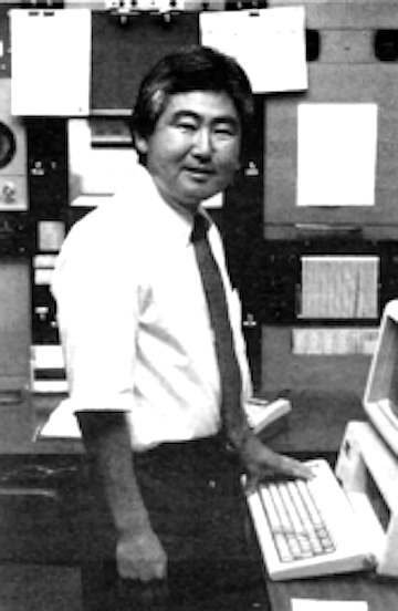
Over our heads, the jet stream rages, with winds howling at up to 150 miles an hour when tropical and arctic air masses collide. “The jet stream dictates where the storms will go,” says meteorologist Wilbur Shigehara. Roaming 30,000 to 50,000 feet up. these “high-level winds are like freeways in the sky. Knowing that the jet stream was coming this way would tell me that a storm would be coming this way.”
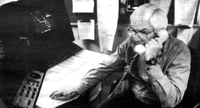
At the National Weather Service office on Pacific Highway, a chest-high row of computers the color of a paradise sky forms an arc around Shigehara. the service’s chief meteorologist. With these computers, he or any of the eight forecasters-technicians in the office can track the jet stream and begin formulating a local forecast. Six a day are prepared by the weather service for the San Diego area.
Jacket off. Shigehara sits down at the keyboard at the left of the arc and. with two fingers, types a code. Numbers and letters appear on the 15-inch screen in front of him. On a screen at his right, a map of curving lines takes shape, superimposed on a portion of earth he has specified, for an altitude he has specified. The forecaster now has a picture of the upper atmosphere. If he wants, he can use yet another screen to magnify a portion of the map or to compare the current picture with that of yesterday or a future day.
Having this three-dimensional structure is important in weather forecasting. Shigehara says, "because you have to study the winds at 30,000 feet to determine what’s going to be on your toes." Still, even the best weather chart captures only one moment of a constantly changing pattern.
The atmosphere is a restless mass of air, more turbulent than the ocean. It’s 260,000 feel deep, and we, bystanders to its power and whims, live at the bottom. Continuous winds scream above us, unheard. Some, bundled together in tubular ribbons, blast through the atmosphere at speeds of up to 250 miles an hour. The number and paths of these jet streams vary from day to day, season to season.
A computer-generated map gives Shigehara a portrait of wind circulation around the Earth by charting isobars, lines that connect points of equal atmospheric pressure. In places, these isobars seem to meander, but eventually they circle around areas of high and low pressure. "Mother Nature says that winds will go from high to low pressure," Shigehara says. And "wind causes weather.”
The wind picture changes depending on altitude. Forecasters here like to study the 500-millibar map. which, though only about 1000 feet up, marks the halfway point of the atmosphere in terms of air pressure, which is billions of times greater at the Earth’s surface than at the edge of the atmosphere. Meteorologists can look at any atmospheric altitude in any part of the world because twice a day, at exactly the same time, about 800 people around the world send balloons into the sky
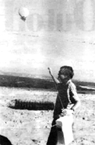
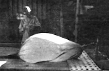
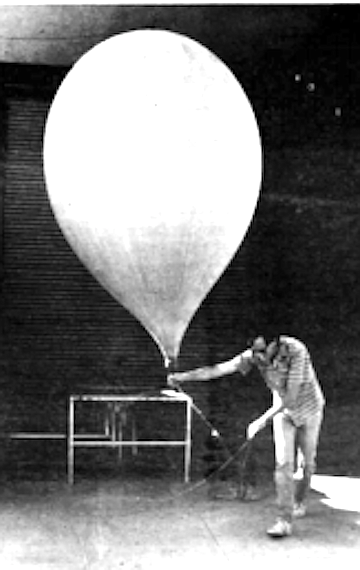
At 2330 Greenwich (or Universal) Mean Time, which is 3:30 p.m. Pacific Daylight Time in San Diego, a technician begins balloon preparation for a 0000 launch. Surrounded by computer equipment in a weather office on Kearny Villa Road, he checks out and loads the battery-powered radiosonde that will send back weather information. He lays out an eight-foot-long balloon and attaches its tip to a gas jet, which is hooked in turn to one of many canisters of hydrogen.
To determine visibility, he peers beyond the airport toward Point Loma, the arm of land that juts into the Pacific Ocean. If he can see the end clearly, it's seven miles. Today he can't. )He calls it six, and hazy.
The flesh-covered balloon is made out of neoprene, a type of latex, and dusted with talc. It feels silky. Inflated to a diameter of 7 feet at ground level, the balloon will expand in the thin air of the upper atmosphere to almost 100 feet before bursting.
Inflation is slow, but gradually the balloon rises and bobs straight up. The balloon is connected to the radiosonde and an orange paper parachute that will carry the device to earth after the balloon bursts. The radio unit, no bigger than a shoebox, weighs less than a pound. Styrofoam protects the delicate instruments that constantly measure temperature, wind, and humidity on both the ascent and descent. A cardboard sheath holds everything tight.
The radiosonde will climb and fall at 15 miles an hour, taking two and a half to three hours to complete its round trip of roughly 200,000 feet. A tracking disk at the weather station will receive its transmissions, once the technician accurately trains the disk on the balloon — a tricky task on cloudy days. The operator has only a minute to find it if it’s lost. After that, it’s gone, and there’s nothing left to do but assemble another.
The National Weather Service office on Pacific Highway occupies several rooms on the second floor of a nondescript building owned by the Port District. Behind it, jet planes blast down the runway at Lindbergh Field. Though muffled, their roar finds its way inside the office. Bookcases cover some walls, and the shelves are lined with binders and manuals full of rules handed down by the National Oceanic and Atmospheric Administration and NOAA’s superior, the U.S. Department of Commerce. Otherwise, the decor includes a couple of large, framed satellite maps, including one of Hurricane Katrina, a perfect spiral cloud formation, off the southern tip of Baja in 1975.
Outside, an American flag flies 24 hours a day because inside, a day never ends. Except for Shigehara, who mostly works a standard 8:30 a.m. to 4:30 p.m., weekday schedule, the forecasters-technicians rotate among three shifts, beginning at 8:00 a.m., 4:00 p.m., and midnight.
Given time, the data coming off the radiosonde launched in San Diego and the 799 others around the world can be accessed by this equipment, which is linked to a main computer near Washington. D.C., that constantly collects, analyzes, and shapes millions of bits of information.
Once all the data are in. the computer begins to make current profiles of wind circulation around the Earth and to project future ones. “This is very important because what happens aloft dictates what happens at the surface. What happens 10.000 miles away will affect the San Diego weather.”
Meteorologists here primarily rely on four computer weather-forecasting models. The first one is ready early in the day. with data still incomplete, and provides “a quick and dirty look,” Shigehara says, at a 48-hour projection of weather from Hawaii to Bermuda. The second is the same map with more detail. The third projects 72 hours into the future on a larger scale: the northern hemisphere. The fourth is complete in the middle of the night, a 132-hour projection. 5.5 days, of the northern hemisphere. Shigehara says the computer “would mock up maps ad infinitum." but San Diego usually cuts off after about a ten-day projection.
By studying these profiles, meteorologists increase their chances for an accurate forecast. “The problem is, it’s only a figment of the computer's imagination.” Shigehara says. “As good as these models are. (the computer] will lead you down the rosy path unless you corroborate with satellite data and so forth." Shigehara's "so forth" includes experience. He’s been in San Diego since 1982. He knows how certain images on a chart or map translate to surface weather locally. “Your mind has to be like a computer and remember incidents in the past.” he says.
This human element guards against what Shigehara calls “computer hacks" forecasting weather. While a person with no meteorology experience could be trained in a day to put out a San Diego forecast using the information from the computer (known as “guidance"), Shigehara says that wouldn’t make an accurate forecast. "There are a lot of events that do not follow the guidance."
Computers have changed forecasting since the late 1960s. when Shigehara began weather forecasting, after obtaining degrees in geology and meteorology. Thirty years ago. forecasters had teletype and facsimile machines instead. They provided much of the same information, only slower. Also, the weather models are better now, Shigehara says, and forecasts have become more accurate.
“Accurate" is a relative term to forecasters, who are sometimes derided for being wrong so often. "People who don’t have anything better to do criticize us weather people." he says with more emotion than usual. "We try our best to put out an accurate forecast. When it goes awry, it hurts our pride, I think. We’ve got our pride on the line." He’s bothered, too. by some weathercasters “that make light of weather, make cartoons out of weather.” Shigehara thinks that as a result, people will not pay attention when weather becomes life threatening. “I don’t think a weathercaster or radio people should make fun of weather. We treat weather as something very, very serious."
Threatening weather doesn’t happen too often in San Diego. In fact, this city’s almost predictably ideal weather most likely would have closed the office at Lindbergh , Field long ago if daily forecasts were the service’s only function. “The primary mission of the National Weather Service is to provide a safety net for life and property for everybody in San Diego.” Shigehara says. It works closely with the Office of Disaster Preparedness regarding flooding, hurricanes, and winds. Also, Shigehara is the senior agricultural forecaster, which is a specialty not practiced by most of the others in this office. His past forecasts of frost have saved San Diego County growers untold losses. “It’s because of the severe weather they (the government) keep us around." Shigehara says.
And severe weather might be on the rise. Shigehara says storms may be getting big again, as they were at the turn of the century. He describes our local weather since 1976 as erratic, with episodes of extremes in heat and cold, rainfall, and drought and says that pattern may be what’s normal, not the benevolent weather most people have come to expect.
“Many scientists feel that the period that San Diego has come through in the ’40s to '60s could be a very unusual period of meteorology." Shigehara says the conclusion of researchers is that extremes and erratic weather here are “a normal sequence of events” in terms of long weather trends. If so, he may have to amend his “three-finger method” of forecasting: It was fair yesterday, it’s fair today, so it’s probably going to be fair tomorrow. Weather patterns like that make things, in his words, a little boring.
That’s an understatement for Grady Svoboda, who has many severe-weather stories from previous assignments, before coming to San Diego in 1986. A Navy veteran, he served in the late ’60s on the U.S.S. Wright, a communications command ship. The Wright would sail into the eyes of hurricanes, and Svoboda. one of few upper-air specialists on the East Coast at the time, would send up weather balloons. He studied meteorology as a civilian, earning a bachelor’s degree in physical geography-climatology. which he describes as a “historic study of meteorology.” Now. much of what he does for the bureau in San Diego ends up as “history”; local forecasts and all data from hourly weather observations are stored in the archives of the National Climatic Data Center is Asheville, North Carolina.
The observation instruments take up one wall in the big main room of the weather service office. It is gray metal with little windows over various gauges, digital readouts and graphs in the making. Above, a clock is set year round for Pacific Standard Time. “Daylight Time doesn’t exist in this office,” Svoboda says. "Atmospheric phenomena relate to true sun time.”
After the Navy and college, Svoboda started his career as a weatherman in Albuquerque, where Wilbur Shigehara also worked. He moved from there to stations in Colorado, where he encountered “hail that broke the backs of pigs and a horse” and dented the double-thick side rims of a pickup bed. The wind could go from calm to 80 or more miles an hour in a matter of minutes, he says. He then spent two years at the station on St. Paul’s Island, a rugged. 36-square-mile patch of land in the Pribilof Islands, in Alaska. Temperatures of minus 35 degrees and winds of 50 knots were common. One airplane a week brought food ordered from Seattle. He and four others kept so busy with air traffic and weather, he says, “there was no time even to eat lunch.”
Some of his freshest and most painful memories resulted from his time in the Pribilofs. Eighty to 100 fishing boats would go down in the Bering Sea in a season, and he used to talk to those on board on high-frequency radio just before they sank and died. “ ‘Well, you’ll be the last man I’ll be talking to,’ and bingo, he was gone.” Svoboda says. “You take it real personal.” Although he and his family have adapted to San Diego, especially the sled dog. who lives indoors on the couch, they hope to return to Alaska or some other remote post, eventually.
At ten minutes till the hour, Svoboda climbs a flight of stairs to the roof for weather observations, which must be taken every hour around the clock. On the roof.
Svoboda sees a small hole in the concrete retaining wall and remembers the night when he tottered up. half asleep, and a bullet whizzed by, jarring him awake more quickly than an alarm clock ever could.
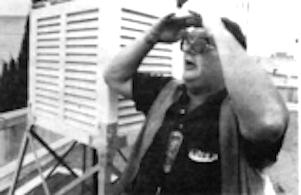
Once on the roof, Svoboda goes about his observations, checking rain gauges, thermometers for maximum and minimum temperatures, and a wet bulb/dry bulb apparatus for calculating humidity. To determine visibility, he peers beyond the airport toward Point Loma. the arm of land that juts into the Pacific Ocean. If he can see the end clearly, it’s seven miles. Today he can’t. He calls it six, and hazy. At night, a series of lights helps to identify distance.
Back downstairs, he charts the data from the wall instruments, which measure cloud height, wind direction and gusts, wave size, and tide, temperatures, dew point, minutes of sunshine, rainfall amounts, and air pressure. Then he rolls his chair up to a computer and begins typing. A kind of “weatherspeak” appears on the terminal above the keyboard, information so abbreviated it makes little sense to an untrained observer: SAN FT 031919 12 SCT 2410. 02Z C8 0VC 4H. 09Z C5 (JVC 3FH. 13Z IFR CIG F. 18Z MVFR H.
It means: San Diego forecast terminal, third day of the month at 1919 Greenwich time. 1200 feet, scattered clouds, winds at 24 degrees (24 equals 240 azimuth, which equals west-southwest) at K) knots; forecast for 0200 Zulu (another name for Greenwich Mean Time), ceiling 800 feet, overcast, four miles visibility with haze; forecast for 0900 Zulu, ceiling 500 feet, overcast, three miles visibility with fog and haze; forecast for 1300 Zulu, Instrument Flight Rules apply. Ceiling (i.e., clouds cover at least six-tenths of the sky), rog; forecast for 1800 Zulu, Marginal Visual Flight Rules apply, Haze.
“All the weather you hear on Good Morning, America, it wouldn’t be there if we didn't take it,” Svoboda says.
From San Diego, the data go to a switch in Kansas City, then to the central computer near Washington. D.C., and finally to the World Meteorological Organization. Svoboda says, “In ten minutes, it goes worldwide. I mean Russians too.” However, “obs,” as they are called, are taken as a courtesy for the airport rather than as an integral function of the weather service. Thus, Svoboda writes up the data on a special machine that transmits it to the Lindbergh Field control tower and airport manager. For the airline industry as a whole, the computer data follow the same path to Washington, then feed down to a central computer in Atlanta.
The final chore for this round of weather observations is making tape recordings — hourly temperatures and humidity readings for the area for the media line, and a full report for NOAA weather radio. The office has a special room and sophisticated equipment. “All of us are trained in radio broadcast school,” Svoboda says. A few hours later this day. Shigehara will close the door on that room to record the 4:00 p.m. weather forecast for a public phone line that can take 20 to 100 rotary calls at a time.
According to Shigehara. "San Diego County is an extremely difficult place to make a forecast. You look at all the normal meteorological problems, and then you throw in the ocean. I know because I forecasted at Wichita Falls, and Albuquerque, and Missoula, Modesto, and Santa Maria. The ocean is something to reckon with.” The Pacific off San Diego can moderate heat and cold, cause a sea breeze that slams down the temperature, and drive in enough moisture to prevent frost. Or not do any of those. The ocean is the “surprise element" in San Diego's forecasts.
Occurring predictably enough but with varying effects is the ocean phenomenon of El Nino. Shigehara says El Nino recurs every five to seven years and lasts one to two years. “Cyclically speaking, one should be coming up soon, in the early 1990s," he says. "We don't know whether the El Nino will cause wet conditions or dry conditions.” According to Shigehara. the 1982-1984 El Nino, which he calls the longest and strongest, caused the hottest summer ever in San Diego in 1984 and the fourth wettest winter on record, 18.26 inches in 1982-83. The following season, rainfall dropped to 5.73 inches. Shigehara says the 1976 drought was an El Nino year, yet the next year's season total was the third highest on record, 18.71 inches.
El Nino occurs when air pressure patterns over the Pacific Ocean reverse themselves. No one knows why. Normally there is an area of low pressure in the western Pacific, which is responsible for the monsoons in Asia, and an area of high pressure in the eastern Pacific. In an El Niho. they switch, Shigehara says. This changes the direction of the wind, which moves the warm current eastward from Asia to the West Coast of the United States. The warm water heats our air and. in turn, alters the storm tracks, bringing us more or less rain.
La Nina, another inexplicable ocean phenomenon, alternates with El Nino and brings cold water to the equator. In Shigehara’s opinion. La Nina, not the “greenhouse effect" as many believe, is to blame for the drought in the West and Midwest. “Very cold water south of the Hawaiian Islands caused high pressure to form there," he says. “That caused the jet stream to break up,” weakening winter storms. “Five thousand miles away. La Nina caused drought.”
Without the ocean, “we would be like Borrego,” Shigehara says. He calls San Diego's climate Mediterranean, the same as Italy on the Mediterranean Sea, and classifies it as arid because of the small amount of rainfall. Relative humidity near the coast ranges from 90 percent in the morning to 57 to 60 percent in the afternoon. The average is 70 to 75 percent, although a five-minute drive inland, humidity falls as much as 20 percent.
For the most part, weather forecasting here is fairly routine. Shigehara says winter is the sunniest and rainiest period, while summer is dry, the sun angle so high that it has moved the jet stream north into Canada. However, “winds can bring moisture up from Mexico and the Gulf to San Diego."
Normally, a high-pressure area centered at Four Corners, where Utah, New Mexico, Colorado, and Arizona meet, and extending from San Diego through the Rockies, creates a lot of heat in the summer. Night and morning low clouds are common, and afternoons are sunny.
Spring, like fall, is windy with occasional storms, and in addition, it starts the pattern of low clouds, usually with clockwork timing in early May. Almost without fail from then through June, throughout the county, days will be cloudy with a marine layer. Yet. according to Shigehara. this marine layer lies over the county even when it can’t be seen. Made up of invisible water vapor, it is identifiable by a change in temperature. Cold air holds less water vapor than warm air, and eventually, its relative humidity — the amount of water vapor the air can hold at a given temperature — reaches 100 percent. The vapor then condenses into visible drops of liquid as dew, fog, clouds, snow, or rain.
Forecasting the weather is “like hunting.” Shigehara says, speeding up his already rapid speaking pace. "You have to always be alert. Every moment you have to be looking for little signs along the way. You can’t just sit down and make a forecast in half an hour. You’ve got to spend hours throughout the day. looking for signs of change: the barograph falling over Nevada or some high-level wind reports coming in over Seattle, pressure that develops between Imperial and San Diego Counties, satellite pictures.”
Every forecast is accurate at the moment it’s made, but things change. “There are too many elements that we do not know about. The atmosphere is so big. we don’t know what outside factors are affecting the storm coming in.” Thus, he makes constant adjustments to an existing forecast. In addition to all the current data, he relies on his "sixth sense.” which he says comes with experience, and on 100 years of historical weather data for the area.
In recent years, forecasting San Diego’s weather has been complicated by changing jet streams and low-pressure areas. “The placement and numbers of lows seems very odd this year," Shigehara says. “Normally we have four to five lows around the whole world. [This year) we have had five and six.” He says these extra lows “bust up the jet stream around the world.” resulting in a number of jet streams and. consequently, areas that are flooding and areas with drought.
As a local example, he points to the three years before this, when areas of high and low pressure, acting "like deflectors on an air conditioner.” broke up the strong jet stream that comes from Hawaii into three weaker jet streams. The strongest one came through San Diego, "leaving the rest of California and the Pacific Northwest drier than normal.” San Diego was wetter, with rain amounting to 14.10 inches in '85- 86. 9.61 inches in ’86- ’87. and 11 to 12 inches in ’87- ’88, most of it in the fall of 87. “This year is very dry.” but Shigehara says that perhaps if its total were added to last year's excess, the two years would equal out to our current average of 9.32 inches.
For Shigehara. that’s one of the symmetries of weather. "Everything has to equal out," he says. “Can’t have a low without a high. When the weather’s good here, it has to be bad somewhere else. Wet here, dry somewhere else."
“The air we breathe goes around the world. It circulates. We are all connected.” This, he says, forms the basis for long-range weather forecasting. “Many meteorologists don’t understand that.
They're myopic. A good meteorologist will look at what happens over Bermuda or Spain or Greenland to determine what’s going to happen in Lemon Grove six hours from now.”
San Diego has been keeping records of temperature since 1872.
The hottest day ever was 110 degrees on September 26, 1963; the lowest, 25 degrees on January 7, 1913. ‘Records will show that San Diego has gradually warmed up from an average temperature near 60 degrees, steadily climbing on a year-to-year basis, [until] about 1982 to 1984,” says meteorologist Wilbur Shigehara. Then it averaged 67 degrees, and it’s been falling again ever since: 1985 was 65 degrees, ‘86 was 64, and ‘87 was 63. However, the summer of 1984 was one of the hottest, and this past April was the hottest April since 1872. “The fifth, sixth, and seventh had record highs,” Shigehara says. “Only four days had a temperature below normal.” There have been erratic extremes of temperature here since 1976.
Rainfall records have been maintained since 1850; and again, since 1976 there have been rain extremes “unlike any other time since we started keeping rainfall figures. Up and down.” Shigehara says that 1988 was the seventh driest January -to-April period on record.


The Convention & Visitors Bureau advertises San Diego as the “only area in the United States with perfect weather." Those days may be ending, according to recent theories, but whether they’re the rule or the exception, our blue skies and fair temperatures can be deceiving.
Over our heads, the jet stream rages, with winds howling at up to 150 miles an hour when tropical and arctic air masses collide. “The jet stream dictates where the storms will go,” says meteorologist Wilbur Shigehara. Roaming 30,000 to 50,000 feet up. these “high-level winds are like freeways in the sky. Knowing that the jet stream was coming this way would tell me that a storm would be coming this way.”
At the National Weather Service office on Pacific Highway, a chest-high row of computers the color of a paradise sky forms an arc around Shigehara. the service’s chief meteorologist. With these computers, he or any of the eight forecasters-technicians in the office can track the jet stream and begin formulating a local forecast. Six a day are prepared by the weather service for the San Diego area.

Jacket off. Shigehara sits down at the keyboard at the left of the arc and. with two fingers, types a code. Numbers and letters appear on the 15-inch screen in front of him. On a screen at his right, a map of curving lines takes shape, superimposed on a portion of earth he has specified, for an altitude he has specified. The forecaster now has a picture of the upper atmosphere. If he wants, he can use yet another screen to magnify a portion of the map or to compare the current picture with that of yesterday or a future day.
Having this three-dimensional structure is important in weather forecasting. Shigehara says, "because you have to study the winds at 30,000 feet to determine what’s going to be on your toes." Still, even the best weather chart captures only one moment of a constantly changing pattern.

The atmosphere is a restless mass of air, more turbulent than the ocean. It’s 260,000 feel deep, and we, bystanders to its power and whims, live at the bottom. Continuous winds scream above us, unheard. Some, bundled together in tubular ribbons, blast through the atmosphere at speeds of up to 250 miles an hour. The number and paths of these jet streams vary from day to day, season to season.
A computer-generated map gives Shigehara a portrait of wind circulation around the Earth by charting isobars, lines that connect points of equal atmospheric pressure. In places, these isobars seem to meander, but eventually they circle around areas of high and low pressure. "Mother Nature says that winds will go from high to low pressure," Shigehara says. And "wind causes weather.”
The wind picture changes depending on altitude. Forecasters here like to study the 500-millibar map. which, though only about 1000 feet up, marks the halfway point of the atmosphere in terms of air pressure, which is billions of times greater at the Earth’s surface than at the edge of the atmosphere. Meteorologists can look at any atmospheric altitude in any part of the world because twice a day, at exactly the same time, about 800 people around the world send balloons into the sky

At 2330 Greenwich (or Universal) Mean Time, which is 3:30 p.m. Pacific Daylight Time in San Diego, a technician begins balloon preparation for a 0000 launch. Surrounded by computer equipment in a weather office on Kearny Villa Road, he checks out and loads the battery-powered radiosonde that will send back weather information. He lays out an eight-foot-long balloon and attaches its tip to a gas jet, which is hooked in turn to one of many canisters of hydrogen.
To determine visibility, he peers beyond the airport toward Point Loma, the arm of land that juts into the Pacific Ocean. If he can see the end clearly, it's seven miles. Today he can't. )He calls it six, and hazy.
The flesh-covered balloon is made out of neoprene, a type of latex, and dusted with talc. It feels silky. Inflated to a diameter of 7 feet at ground level, the balloon will expand in the thin air of the upper atmosphere to almost 100 feet before bursting.
Inflation is slow, but gradually the balloon rises and bobs straight up. The balloon is connected to the radiosonde and an orange paper parachute that will carry the device to earth after the balloon bursts. The radio unit, no bigger than a shoebox, weighs less than a pound. Styrofoam protects the delicate instruments that constantly measure temperature, wind, and humidity on both the ascent and descent. A cardboard sheath holds everything tight.

The radiosonde will climb and fall at 15 miles an hour, taking two and a half to three hours to complete its round trip of roughly 200,000 feet. A tracking disk at the weather station will receive its transmissions, once the technician accurately trains the disk on the balloon — a tricky task on cloudy days. The operator has only a minute to find it if it’s lost. After that, it’s gone, and there’s nothing left to do but assemble another.
The National Weather Service office on Pacific Highway occupies several rooms on the second floor of a nondescript building owned by the Port District. Behind it, jet planes blast down the runway at Lindbergh Field. Though muffled, their roar finds its way inside the office. Bookcases cover some walls, and the shelves are lined with binders and manuals full of rules handed down by the National Oceanic and Atmospheric Administration and NOAA’s superior, the U.S. Department of Commerce. Otherwise, the decor includes a couple of large, framed satellite maps, including one of Hurricane Katrina, a perfect spiral cloud formation, off the southern tip of Baja in 1975.
Outside, an American flag flies 24 hours a day because inside, a day never ends. Except for Shigehara, who mostly works a standard 8:30 a.m. to 4:30 p.m., weekday schedule, the forecasters-technicians rotate among three shifts, beginning at 8:00 a.m., 4:00 p.m., and midnight.
Given time, the data coming off the radiosonde launched in San Diego and the 799 others around the world can be accessed by this equipment, which is linked to a main computer near Washington. D.C., that constantly collects, analyzes, and shapes millions of bits of information.
Once all the data are in. the computer begins to make current profiles of wind circulation around the Earth and to project future ones. “This is very important because what happens aloft dictates what happens at the surface. What happens 10.000 miles away will affect the San Diego weather.”
Meteorologists here primarily rely on four computer weather-forecasting models. The first one is ready early in the day. with data still incomplete, and provides “a quick and dirty look,” Shigehara says, at a 48-hour projection of weather from Hawaii to Bermuda. The second is the same map with more detail. The third projects 72 hours into the future on a larger scale: the northern hemisphere. The fourth is complete in the middle of the night, a 132-hour projection. 5.5 days, of the northern hemisphere. Shigehara says the computer “would mock up maps ad infinitum." but San Diego usually cuts off after about a ten-day projection.
By studying these profiles, meteorologists increase their chances for an accurate forecast. “The problem is, it’s only a figment of the computer's imagination.” Shigehara says. “As good as these models are. (the computer] will lead you down the rosy path unless you corroborate with satellite data and so forth." Shigehara's "so forth" includes experience. He’s been in San Diego since 1982. He knows how certain images on a chart or map translate to surface weather locally. “Your mind has to be like a computer and remember incidents in the past.” he says.
This human element guards against what Shigehara calls “computer hacks" forecasting weather. While a person with no meteorology experience could be trained in a day to put out a San Diego forecast using the information from the computer (known as “guidance"), Shigehara says that wouldn’t make an accurate forecast. "There are a lot of events that do not follow the guidance."
Computers have changed forecasting since the late 1960s. when Shigehara began weather forecasting, after obtaining degrees in geology and meteorology. Thirty years ago. forecasters had teletype and facsimile machines instead. They provided much of the same information, only slower. Also, the weather models are better now, Shigehara says, and forecasts have become more accurate.
“Accurate" is a relative term to forecasters, who are sometimes derided for being wrong so often. "People who don’t have anything better to do criticize us weather people." he says with more emotion than usual. "We try our best to put out an accurate forecast. When it goes awry, it hurts our pride, I think. We’ve got our pride on the line." He’s bothered, too. by some weathercasters “that make light of weather, make cartoons out of weather.” Shigehara thinks that as a result, people will not pay attention when weather becomes life threatening. “I don’t think a weathercaster or radio people should make fun of weather. We treat weather as something very, very serious."
Threatening weather doesn’t happen too often in San Diego. In fact, this city’s almost predictably ideal weather most likely would have closed the office at Lindbergh , Field long ago if daily forecasts were the service’s only function. “The primary mission of the National Weather Service is to provide a safety net for life and property for everybody in San Diego.” Shigehara says. It works closely with the Office of Disaster Preparedness regarding flooding, hurricanes, and winds. Also, Shigehara is the senior agricultural forecaster, which is a specialty not practiced by most of the others in this office. His past forecasts of frost have saved San Diego County growers untold losses. “It’s because of the severe weather they (the government) keep us around." Shigehara says.
And severe weather might be on the rise. Shigehara says storms may be getting big again, as they were at the turn of the century. He describes our local weather since 1976 as erratic, with episodes of extremes in heat and cold, rainfall, and drought and says that pattern may be what’s normal, not the benevolent weather most people have come to expect.
“Many scientists feel that the period that San Diego has come through in the ’40s to '60s could be a very unusual period of meteorology." Shigehara says the conclusion of researchers is that extremes and erratic weather here are “a normal sequence of events” in terms of long weather trends. If so, he may have to amend his “three-finger method” of forecasting: It was fair yesterday, it’s fair today, so it’s probably going to be fair tomorrow. Weather patterns like that make things, in his words, a little boring.
That’s an understatement for Grady Svoboda, who has many severe-weather stories from previous assignments, before coming to San Diego in 1986. A Navy veteran, he served in the late ’60s on the U.S.S. Wright, a communications command ship. The Wright would sail into the eyes of hurricanes, and Svoboda. one of few upper-air specialists on the East Coast at the time, would send up weather balloons. He studied meteorology as a civilian, earning a bachelor’s degree in physical geography-climatology. which he describes as a “historic study of meteorology.” Now. much of what he does for the bureau in San Diego ends up as “history”; local forecasts and all data from hourly weather observations are stored in the archives of the National Climatic Data Center is Asheville, North Carolina.
The observation instruments take up one wall in the big main room of the weather service office. It is gray metal with little windows over various gauges, digital readouts and graphs in the making. Above, a clock is set year round for Pacific Standard Time. “Daylight Time doesn’t exist in this office,” Svoboda says. "Atmospheric phenomena relate to true sun time.”
After the Navy and college, Svoboda started his career as a weatherman in Albuquerque, where Wilbur Shigehara also worked. He moved from there to stations in Colorado, where he encountered “hail that broke the backs of pigs and a horse” and dented the double-thick side rims of a pickup bed. The wind could go from calm to 80 or more miles an hour in a matter of minutes, he says. He then spent two years at the station on St. Paul’s Island, a rugged. 36-square-mile patch of land in the Pribilof Islands, in Alaska. Temperatures of minus 35 degrees and winds of 50 knots were common. One airplane a week brought food ordered from Seattle. He and four others kept so busy with air traffic and weather, he says, “there was no time even to eat lunch.”
Some of his freshest and most painful memories resulted from his time in the Pribilofs. Eighty to 100 fishing boats would go down in the Bering Sea in a season, and he used to talk to those on board on high-frequency radio just before they sank and died. “ ‘Well, you’ll be the last man I’ll be talking to,’ and bingo, he was gone.” Svoboda says. “You take it real personal.” Although he and his family have adapted to San Diego, especially the sled dog. who lives indoors on the couch, they hope to return to Alaska or some other remote post, eventually.
At ten minutes till the hour, Svoboda climbs a flight of stairs to the roof for weather observations, which must be taken every hour around the clock. On the roof.
Svoboda sees a small hole in the concrete retaining wall and remembers the night when he tottered up. half asleep, and a bullet whizzed by, jarring him awake more quickly than an alarm clock ever could.
Once on the roof, Svoboda goes about his observations, checking rain gauges, thermometers for maximum and minimum temperatures, and a wet bulb/dry bulb apparatus for calculating humidity. To determine visibility, he peers beyond the airport toward Point Loma. the arm of land that juts into the Pacific Ocean. If he can see the end clearly, it’s seven miles. Today he can’t. He calls it six, and hazy. At night, a series of lights helps to identify distance.
Back downstairs, he charts the data from the wall instruments, which measure cloud height, wind direction and gusts, wave size, and tide, temperatures, dew point, minutes of sunshine, rainfall amounts, and air pressure. Then he rolls his chair up to a computer and begins typing. A kind of “weatherspeak” appears on the terminal above the keyboard, information so abbreviated it makes little sense to an untrained observer: SAN FT 031919 12 SCT 2410. 02Z C8 0VC 4H. 09Z C5 (JVC 3FH. 13Z IFR CIG F. 18Z MVFR H.
It means: San Diego forecast terminal, third day of the month at 1919 Greenwich time. 1200 feet, scattered clouds, winds at 24 degrees (24 equals 240 azimuth, which equals west-southwest) at K) knots; forecast for 0200 Zulu (another name for Greenwich Mean Time), ceiling 800 feet, overcast, four miles visibility with haze; forecast for 0900 Zulu, ceiling 500 feet, overcast, three miles visibility with fog and haze; forecast for 1300 Zulu, Instrument Flight Rules apply. Ceiling (i.e., clouds cover at least six-tenths of the sky), rog; forecast for 1800 Zulu, Marginal Visual Flight Rules apply, Haze.
“All the weather you hear on Good Morning, America, it wouldn’t be there if we didn't take it,” Svoboda says.
From San Diego, the data go to a switch in Kansas City, then to the central computer near Washington. D.C., and finally to the World Meteorological Organization. Svoboda says, “In ten minutes, it goes worldwide. I mean Russians too.” However, “obs,” as they are called, are taken as a courtesy for the airport rather than as an integral function of the weather service. Thus, Svoboda writes up the data on a special machine that transmits it to the Lindbergh Field control tower and airport manager. For the airline industry as a whole, the computer data follow the same path to Washington, then feed down to a central computer in Atlanta.
The final chore for this round of weather observations is making tape recordings — hourly temperatures and humidity readings for the area for the media line, and a full report for NOAA weather radio. The office has a special room and sophisticated equipment. “All of us are trained in radio broadcast school,” Svoboda says. A few hours later this day. Shigehara will close the door on that room to record the 4:00 p.m. weather forecast for a public phone line that can take 20 to 100 rotary calls at a time.
According to Shigehara. "San Diego County is an extremely difficult place to make a forecast. You look at all the normal meteorological problems, and then you throw in the ocean. I know because I forecasted at Wichita Falls, and Albuquerque, and Missoula, Modesto, and Santa Maria. The ocean is something to reckon with.” The Pacific off San Diego can moderate heat and cold, cause a sea breeze that slams down the temperature, and drive in enough moisture to prevent frost. Or not do any of those. The ocean is the “surprise element" in San Diego's forecasts.
Occurring predictably enough but with varying effects is the ocean phenomenon of El Nino. Shigehara says El Nino recurs every five to seven years and lasts one to two years. “Cyclically speaking, one should be coming up soon, in the early 1990s," he says. "We don't know whether the El Nino will cause wet conditions or dry conditions.” According to Shigehara. the 1982-1984 El Nino, which he calls the longest and strongest, caused the hottest summer ever in San Diego in 1984 and the fourth wettest winter on record, 18.26 inches in 1982-83. The following season, rainfall dropped to 5.73 inches. Shigehara says the 1976 drought was an El Nino year, yet the next year's season total was the third highest on record, 18.71 inches.
El Nino occurs when air pressure patterns over the Pacific Ocean reverse themselves. No one knows why. Normally there is an area of low pressure in the western Pacific, which is responsible for the monsoons in Asia, and an area of high pressure in the eastern Pacific. In an El Niho. they switch, Shigehara says. This changes the direction of the wind, which moves the warm current eastward from Asia to the West Coast of the United States. The warm water heats our air and. in turn, alters the storm tracks, bringing us more or less rain.
La Nina, another inexplicable ocean phenomenon, alternates with El Nino and brings cold water to the equator. In Shigehara’s opinion. La Nina, not the “greenhouse effect" as many believe, is to blame for the drought in the West and Midwest. “Very cold water south of the Hawaiian Islands caused high pressure to form there," he says. “That caused the jet stream to break up,” weakening winter storms. “Five thousand miles away. La Nina caused drought.”
Without the ocean, “we would be like Borrego,” Shigehara says. He calls San Diego's climate Mediterranean, the same as Italy on the Mediterranean Sea, and classifies it as arid because of the small amount of rainfall. Relative humidity near the coast ranges from 90 percent in the morning to 57 to 60 percent in the afternoon. The average is 70 to 75 percent, although a five-minute drive inland, humidity falls as much as 20 percent.
For the most part, weather forecasting here is fairly routine. Shigehara says winter is the sunniest and rainiest period, while summer is dry, the sun angle so high that it has moved the jet stream north into Canada. However, “winds can bring moisture up from Mexico and the Gulf to San Diego."
Normally, a high-pressure area centered at Four Corners, where Utah, New Mexico, Colorado, and Arizona meet, and extending from San Diego through the Rockies, creates a lot of heat in the summer. Night and morning low clouds are common, and afternoons are sunny.
Spring, like fall, is windy with occasional storms, and in addition, it starts the pattern of low clouds, usually with clockwork timing in early May. Almost without fail from then through June, throughout the county, days will be cloudy with a marine layer. Yet. according to Shigehara. this marine layer lies over the county even when it can’t be seen. Made up of invisible water vapor, it is identifiable by a change in temperature. Cold air holds less water vapor than warm air, and eventually, its relative humidity — the amount of water vapor the air can hold at a given temperature — reaches 100 percent. The vapor then condenses into visible drops of liquid as dew, fog, clouds, snow, or rain.
Forecasting the weather is “like hunting.” Shigehara says, speeding up his already rapid speaking pace. "You have to always be alert. Every moment you have to be looking for little signs along the way. You can’t just sit down and make a forecast in half an hour. You’ve got to spend hours throughout the day. looking for signs of change: the barograph falling over Nevada or some high-level wind reports coming in over Seattle, pressure that develops between Imperial and San Diego Counties, satellite pictures.”
Every forecast is accurate at the moment it’s made, but things change. “There are too many elements that we do not know about. The atmosphere is so big. we don’t know what outside factors are affecting the storm coming in.” Thus, he makes constant adjustments to an existing forecast. In addition to all the current data, he relies on his "sixth sense.” which he says comes with experience, and on 100 years of historical weather data for the area.
In recent years, forecasting San Diego’s weather has been complicated by changing jet streams and low-pressure areas. “The placement and numbers of lows seems very odd this year," Shigehara says. “Normally we have four to five lows around the whole world. [This year) we have had five and six.” He says these extra lows “bust up the jet stream around the world.” resulting in a number of jet streams and. consequently, areas that are flooding and areas with drought.
As a local example, he points to the three years before this, when areas of high and low pressure, acting "like deflectors on an air conditioner.” broke up the strong jet stream that comes from Hawaii into three weaker jet streams. The strongest one came through San Diego, "leaving the rest of California and the Pacific Northwest drier than normal.” San Diego was wetter, with rain amounting to 14.10 inches in '85- 86. 9.61 inches in ’86- ’87. and 11 to 12 inches in ’87- ’88, most of it in the fall of 87. “This year is very dry.” but Shigehara says that perhaps if its total were added to last year's excess, the two years would equal out to our current average of 9.32 inches.
For Shigehara. that’s one of the symmetries of weather. "Everything has to equal out," he says. “Can’t have a low without a high. When the weather’s good here, it has to be bad somewhere else. Wet here, dry somewhere else."
“The air we breathe goes around the world. It circulates. We are all connected.” This, he says, forms the basis for long-range weather forecasting. “Many meteorologists don’t understand that.
They're myopic. A good meteorologist will look at what happens over Bermuda or Spain or Greenland to determine what’s going to happen in Lemon Grove six hours from now.”
San Diego has been keeping records of temperature since 1872.
The hottest day ever was 110 degrees on September 26, 1963; the lowest, 25 degrees on January 7, 1913. ‘Records will show that San Diego has gradually warmed up from an average temperature near 60 degrees, steadily climbing on a year-to-year basis, [until] about 1982 to 1984,” says meteorologist Wilbur Shigehara. Then it averaged 67 degrees, and it’s been falling again ever since: 1985 was 65 degrees, ‘86 was 64, and ‘87 was 63. However, the summer of 1984 was one of the hottest, and this past April was the hottest April since 1872. “The fifth, sixth, and seventh had record highs,” Shigehara says. “Only four days had a temperature below normal.” There have been erratic extremes of temperature here since 1976.
Rainfall records have been maintained since 1850; and again, since 1976 there have been rain extremes “unlike any other time since we started keeping rainfall figures. Up and down.” Shigehara says that 1988 was the seventh driest January -to-April period on record.
Comments